
About this page
Latent heat is an important driver of the atmosphere, along with heat from the sun and the spin of the earth. Few books written for sailors give it a mention. This page sets out to rectify that.
Related pages
- How the Coriolis effect really works.
- How pressure differences are formed
- How the atmosphere is heated and cooled
- Why air moves
On this page
Latent Heat – what it is and how much heat?
Cumulus and Cumuloo-nimbus
Hurricanes and other lows
what is latent heat?
This is for those who did not do physics at school and, perhaps, to refresh memories of those that did. The usual example given is a pan of water on a stove. The water temperature will increase to 100°C but no further. Continuing to supply heat will cause the water to evaporate. If the air holding that water vapour cools and the vapour condense back to water, te heat that caused it to evaporate will be released. When you wet your finger and hold it up in the wind it feels cold. The reason is that the water is evaporating and needs neat to do so.
Similarly if heat is applied to a block of ice it causes the ice to melt. If the water the freezes it releases that heat. On potentially frosty nights, to protect the blossom, farmers used to spray their tress with water. As it got colder, the water would freeze and give off heat.
How much heat is involved?
It takes 334 kJ to melt a kg of ice and 2260 kJ to evaporate 1 kg of water. A moderate sized thunderstorm cloud – a cumulo-nimbus - might be about 10 km x 10 km x 10 km = 1012 m^3^. A fairly modest absolute humidity of air at sea level in our latitudes might be about 10 g of water vapour per m^3^ .
So, in our modest thunder cloud there could be, at least, 1012 x 10 g = 1 x 10¹⁰ kg of water. That would release about 2.26 x 10¹³ kJ just by condensation. More heat would be released when the water in the cloud froze.
An A bomb releases ~ ] 4 x 10⁶ kJ and an H Bomb ~ 8.4 x 10 13 kJ. So, our small cumulo-nimbus is of comparable size to an H-bomb.
Cumulus and cumulo-nimbus clouds
Cumulus clouds are formed when air near the ground or sea is warmed and rises like bubbles of air in a pan over a heated stove. As the air rises, it expands and cools. When it cools enough water vapour starts to condense into droplets of water and in so doing, releases latent heat. That heat makes the air more buoyant.
The bubbles of air rise within the cloud until they burst out of the top. The water then evaporates, that takes heat from the air which cools and then falls outside the cloud as more bubbles rise within it.
This is an example of small cumulus (heaped) clouds. Typical lifetimes of such clouds might be up to an hour or so.

Watch these clouds carefully and you will see bubbles emerging from the tops and then fragment as the subside down the side.
When there is enough heating from the ground or when the air is cold enough for the sea to warm the air enough, these cumulus clouds can grow to become quite deep, maybe a few km deep. This is an example of fairly large cumulus clouds – known as cumulus congestus.
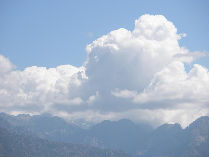
Sometimes when the clouds are a little larger they can give showers. The drops in the cloud grow by hitting each other to coalesce and get big enough to fall as light showers.. this was such a day.
These clouds are entirely composed of liquid water drops even though temperatures may be well below 0°C. Drops can be super-cooled to quite low temperatures, even as low as -40°C if the drops are very small. However, at some stage, if conditions are right some of the drops in the cloud freeze then that releases more latent heat and increased buoyancy so that the cloud gets a new lease of life. Tops can often reach the tropopause, typically 10 to 12 km high. This has two effects –
First, the ice particles evaporate much more slowly than water drops. The cloud tops take on a mure fuzzy appearance as the top often spreads out at the tropopause – a temperature inversion. The ice particles within the cloud grow faster than the water drops to form snow or hail . The freezing of the drops results in a separation of electric charge resulting in thunder and lightning.
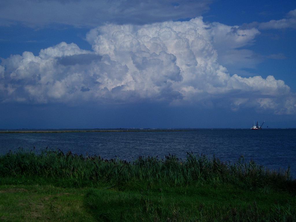
Typical total lifetime of such a cumulo-nimbus might be about 6 hours. Some 30 – 40 minutes after that photograph was taken the cloud had virtually disappeared. It was impossible to see which bits of cloud were the remains of this giant.
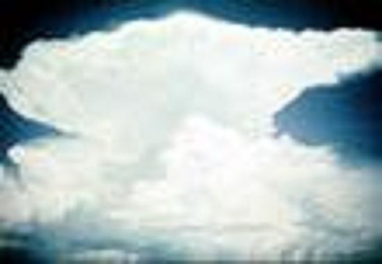
This is a large cumulus cloud turning into a cumulo nimbus. When the top has frozen (glaciated_ the top often looks like an anvil.
Hurricanes and extra-tropical lows
Hurricanes are some of the more spectacular of natural events. Many Atlantic hurricanes start as Easterly waves. These are small disturbances that form, frequently near the Cape Verde Islands, and move westwards in the Trade winds. They can look like this.
Essentially, they are a group of large thunderstorms. If the ocean is warm enough over a large enough area, then these can develop into a hurricane. Much of the energy comes from latent heat. Figures usually quoted are that the sea should be warmer than 26°over an area comparable with the mainland USA.
It has been estimated that a hurricane produces energy equivalent to one H-bomb every 8 minutes.
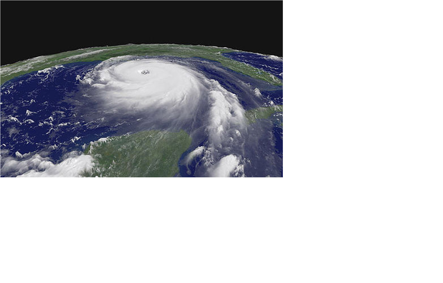
Note the counter-clockwise swirl.
A significant factor in hurricane formation is that there should not be too much change in wind speed with height. If there is, then the top of the familiar spiralling cloud will get ripped away from the bottom. The S Atlantic has a stronger wind shear than the north and it is significant that there has only been one hurricane ever reported in the South Atlantic and that was in 2003, globally, a hot year, at least over Europe. It looked like this.
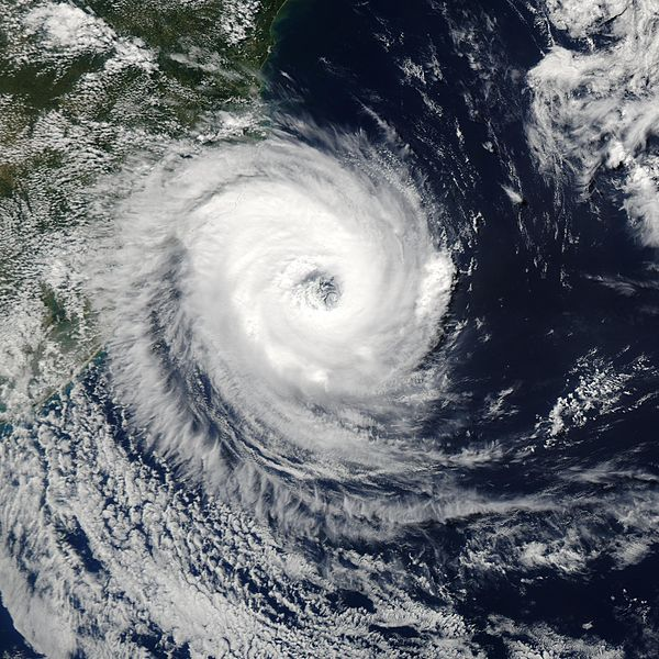
Note the clockwise swirl of this southern hemisphere storm.
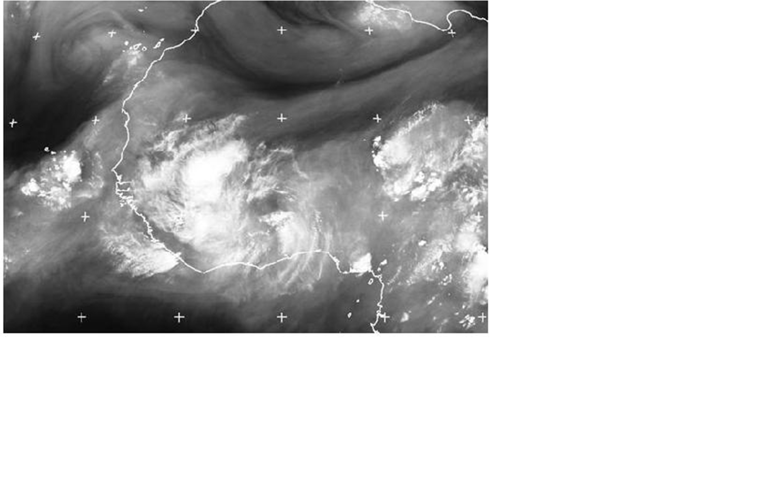
Extra-tropical depressions, such as those that cross the North Atlantic also derive much of their energy from latent heat. The "Mike Fish" storm of October 1987 was one where the latent heat effect was particularly marked.
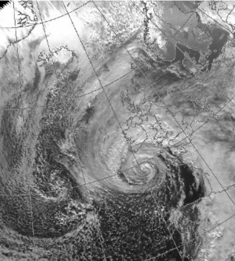
This was the satellite picture of the 1987 storm. Note the difference between this and the hurricanes shown on this page.
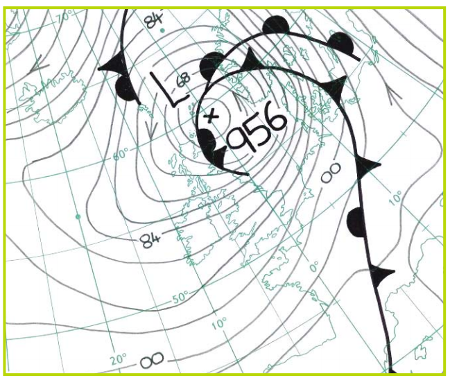
Here is the synoptic chart for 1200 UTC on 16 October 1987’
Studies of this storm after the event showed that there was some very moist air in the mid-troposphere that got engaged by the low. Observations at the time did not show this at the time and computer models were not so good as they are today.