
What this page is about
This page discusses the dissemination of Marine Safety Information particularly to leisure sailors. Much of what is said here appeared in the January, 2015 edition of Navigation News, published by the Royal Institute of Navigation.
Summary
The Internet is here to stay. Sailors, particularly leisure sailors are using it as a means of obtaining MSI. Those providing MSI should take that into account. They should not assume that everyone will use traditional communications even though it might be argued that they should. Providers of MSI are advised to ensure that all MSI is readily available on-line whether by broad or narrow band systems.
Related pages
- SOLAS and the GMDSS - how they apply to leisure sailors
- A warning shot from the US Coastguard
- A threat to Internet services?
On this page –
The GNDSS
Inshore MSI
Offshore MSI
High Seas MSI
Communications Technology
Accessing the InteretI
MSI by email
The consequences
The Future?
IMO Implications
Current state of play Note the changes in Météo France on-line services.
Acknowledgements
The GMDSS
Navigation warnings, weather warnings, repeats of Mayday or Pan-Pan messages, weather forecasts and so on are known collectively as MSI. Messages are broadcast as part of the GMDSS (Global Maritime Distress and Safety System,) so that anyone at sea or going to sea ,anywhere in the world, should have adequate and timely warning of potential or actual hazards. The GMDSS concept is a “Push” system. Users switch on their equipment, ensure it is tuned to the correct frequency and read or listen to the information that arrives.
Calls on VHF to a coastguard, telephone requests or browsing a web site are all “Pull” systems. Users take positive action to obtain information. That requires up to date knowledge of data sources and competence in the use of any necessary equipment.
In general, the GMDSS has worked well over many years but from the perspective of a leisure sailor, the system is rather more unreliable than we would like to believe. It is now seen as an anachronism in the modern computer age and its fitness for purpose in the 21st century is in doubt.
Inshore
Out to about 25 miles, MSI is broadcast in voice on marine VHF from coastal radio stations. Like all terrestrial radio, reception is subject to several factors. Topography, interference from other stations, distance from transmitters can have adverse effects on reception. For small vessels if not large ones, reception can vary over short distances from being good to being patchy or effectively non-existent.
To receive these voice broadcasts requires personal attention; on a short-handed vessel it is all too easy to miss a transmission. The need to change a sail or the presence of other vessels may well be of more immediate importance.
Offshore
Up to 200 miles or so from the coasts of many countries MSI is broadcast on NAVTEX, a telex over radio system. This allows automatic reception of messages. Apart from switching on the receiver and selecting what data are to be recorded, no further personal attention is required.
Reception is generally good over the sea but unreliable near land. At night, interference due to sky wave propagation is an intractable and serious problem.
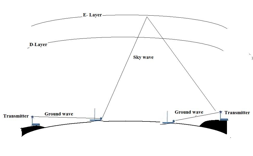
Day time reception is by ground wave only. At night, weakening of ionisation in the stratosphere allows signals to penetrate the D-layer and bounce back to earth from higher levels.
High Seas
Beyond NAVTEX range, the recommended way to receive MSI is by Inmarsat/Iridium EGC, available globally. However, for a variety of reasons, including cost, few leisure yachts carry these systems
MSI is broadcast by some coastal radio stations on MF/HF/SSB. These transmissions are subject to various kinds of interference and reception difficulties. Skill and practice are required with some knowledge of radio propagation.
Current communications technology
MF/HF/SSB radio is 1950s technology and there are problems with transmitter equipment maintenance. Radioteletype (including NAVTEX)) and Radio-facsimile signals are intended to drive mechanical devices. Their slow speeds restrict the amounts of data that can be broadcast. It can take 20 minutes to receive one synoptic chart of the Atlantic using Radio-facsimile from the German station at Pinneberg
Marine VHF, 1960s technology, must now be considered to have a limited lifetime. Even the relatively new Inmarsat-C has data speeds measured in 100s of bits/second rather than megabytes. Iridium is much faster.
The large amounts of data now available, the speeds of the Internet and the availability of satellite communications all suggest that a review of marine communications, including the GMDSS, is long overdue. There are no signs that this is happening in any way that might help the leisure sailor or any other sailor on a vessel not required under the SOLAS Convention to carry Inmarsat-C, Iridium or a HF/SSB transceiver, . It may take a major maritime disaster to highlight the problems as did the loss of the Titanic over 100 years ago.
Ideally, NAVTEX and Inmarsat-C would be high speed, satellite based systems. Receivers would be available at a cost similar to current NAVTEX sets. However, it is difficult to see such a system being implemented in the foreseeable future.
The Internet as a de facto alternative
Coastal sailors are increasingly using the Internet as their preferred source of weather information. That could extend to navigation warnings now available on-line. The growth of terrestrial 3G, 4G and now 5G (mobile broadband) networks has resulted in virtually continuous Internet availability when on land, before going to sea, and when a few miles out to sea. With a dedicated aerial reception, can be possible up to 50 km or more.
However, it is not always easy to set up a mobile data contract when abroad. A sailor might not spend much time in a country or might have arrived after a sea or ocean passage and, because of radio propagation issues, require Internet contact for safety reasons but not be able to arrange a contract. Even around some developed countries, topographic effects can limit mobile network availability. Western coastal areas of Scotland are poorly served, for example.
In these cases, the fallback can be to use email over a roaming cell phone or a satellite telephone. Even without a modern cell phone, it is often possible to send and receive emails using the General Packet Radio System, sometimes called 2.5G. Small data volumes cost little even when roaming.
Some long-distance sailors are now using satellite telephones. Iridium gives global cover and there are relatively cheap text only handsets with cost-effective, flexible contracts suitable for those on occasional ocean crossings or intermittent needs. Browsing is expensive but small emails can be affordable.
What Email can provide
About 15 years ago, American long distance sailors developed SailMail.com, a user funded network of coastal radio stations. Using a modem attached to a radio set it is possible to transmit and receive emails. Effectively, they bolted Internet technology onto old-fashioned radio.
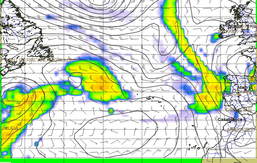
Using the associated free-to-all Saildocs.com service, emails are used to request and receive GRIB (Gridded Binary) data giving forecasts direct from NWP (Numerical Weather Prediction) models such as the NOAA Global Forecast system.
Data to produce GRIB forecast charts at 24 hour intervals from T=0 to T=120 hours for the large area shown here would be received in an email of size 50 kb, less than 10 kb a chart. Several free viewers can be used to display winds, isobars and rainfall.
 ,
, Data received by email displayed in the XyGribviewer.
Maybe more significantly, email can be used to request and receive GMDSS weather forecast texts published on the Internet sites of national weather services. All the text of such webpages can be received as an email usually less than 3 kb in size. This requires knowledge of the URLs of marine forecasts and, in turn, requires such URLs to be unchanging.
This use of email to send and receive text messages has been taken up by others such as MailASail.com and the radio amateurs (HAMs) through Winlink.
Consequences of relying on the Internet
One of the impacts of satellite telephones is that some blue water sailors may not see the need to obtain the Long Range Radio Certificate. They might only carry a MF/HF/SSB receiver but not necessarily a transceiver. They will not be able to transmit Mayday or Pan-pan messages, make contact with other vessels nor benefit from cruiser nets. Similarly, fewer of those who sail primarily near the coast will install NAVTEX than is currently the case.
One obvious consequential danger is that users will come to regard GMDSS services as “Pull” rather than “Push.” Warnings will be missed as will new forecasts and other vital information.
A second, less obvious danger is the increased use of purely objective, computer produced, forecasts such as GRIB data and products derived from them. These contain no human input or vetting. Seemingly location or small area specific forecasts are proliferating but these do not meet the needs of the GMDSS. They can give a false sense of security.
A cardinal virtue of GMDSS forecasts is that they are written by human forecasters. Although based on computer output the human, subjective input adds much value and is a significant contribution to safety. These forecasts are necessarily general in nature but MUST include warning information about possible weather hazards. Depending upon whether a forecast is for the high seas, offshore (shipping forecast) or inshore areas, hazards include storm (F10), gale force (F8) or strong winds (F6 or 7.) Fog, thunderstorms, squalls should always be mentioned.
Of course, there is far more detail in the weather than can be represented in GMDSS texts. Whilst some “unofficial” forecasts may claim to represent small detail it is, in fact, impossible to do so except in some probabilistic sense. Small weather details have short lifetimes that limit predictability.
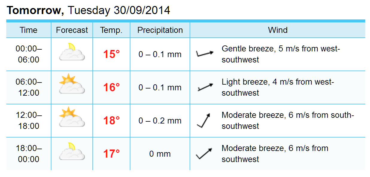
Despite the addition of text, this forecast and others like it, are purely objective
Forecasts, such as this, whether from national weather services or private companies, should always be used in the light of GMDSS forecasts. Maximum wind strengths can be badly under-forecast and locally quite wrong. Visibility can be dangerously over-forecast. Sailors are going to use them, and do so now, but should also have GMDSS texts prominently and easily available
The future?
There will be a user led evolution; for many leisure sailors the Internet will become the prime source of weather services and, perhaps to a lesser extent, navigation warnings. This might be either by satellite, probably the most reliable, or terrestrial communication services.
Some blue water sailors will become largely dependent on satellite systems. Others may well carry a satellite system but, more prudently, also continue to carry MF/HF/SSB transceivers, preferably with Digital Selective Calling. Those making short, say up to four or five day passages, will have the option of supplementing GMDSS broadcasts by use of satellite systems. Those who sail primarily near the coast with only short sea passages are more likely to continue using terrestrial communications based Internet services with good aerial systems and signal amplification.
Implications for MSI providers
It is not clear how the main GMDSS communications systems, NAVTEX and Inmarsat-C, will evolve in response to 21st century data speeds and developing technology. The use of Iridium is a first step. However, by the time any such improvements are implemented, leisure sailors and, probably, other users of small craft will have become accustomed to the availability, speeds and range of services on the Internet.
In the interest of marine safety, those responsible for distributing MSI should be aware of these trends on non-convention vessels. From a user point of view the following is a list of actions needed in the interests of safety at sea.
1. All weather and navigation MSI should be made readily and easily available on-line.
2. Webpages of MSI should have good, rapid updating procedures.
3. All MSI webpages should have static URLs capable of being bookmarked
4. MSI URLs should not be changed without adequate notice and overlapping.
5. Changes to MSI web page locations should always have redirect facilities.
For weather forecasts, items 1 to 3 are met by many countries. A notable exception is the Météo France website where no marine forecast texts have static URLS. Strangely, the GMDSS site has High Seas forecasts with static URLs but NAVTEX forecasts that are not. A vessel at sea without broadband access cannot obtain these texts using email.
Navigation warnings appear on many marine authority websites but rarely in a form that can be usefully bookmarked. An exception is Germany – with links to texts of recent North Sea and Southern Baltic NAVTEX messages available on the Deutscher Wetterdienst site. This is a system that could usefully be repeated elsewhere.
Current state of play
- UK marine forecasts in a clear, no frills page can be bookmarked at the Marine Home page. These can be used by the Saildocs request system. See, also, my NW Europe page
- All DWD marine forecasts are now on text only web pages. All can be accessed using Saildocs.
- French marine forecasts can be bookmarked from their Marine Home page.. These are “heavy” downloads but can be obtained using Saildocs.
- Spanish coastal forecasts can be book marked from the AEMet Marine Home page. These can be obtained by email using Saildocs. Offshore (NAVTEX) area forecast can be bookmarked and obtained using email but only for one sea area at a time.
Acknowledgements
Thanks are due to the Regulation and Technical Services Group and the Blue Water Section of the Cruising Association for constructive comments and advice.