 |
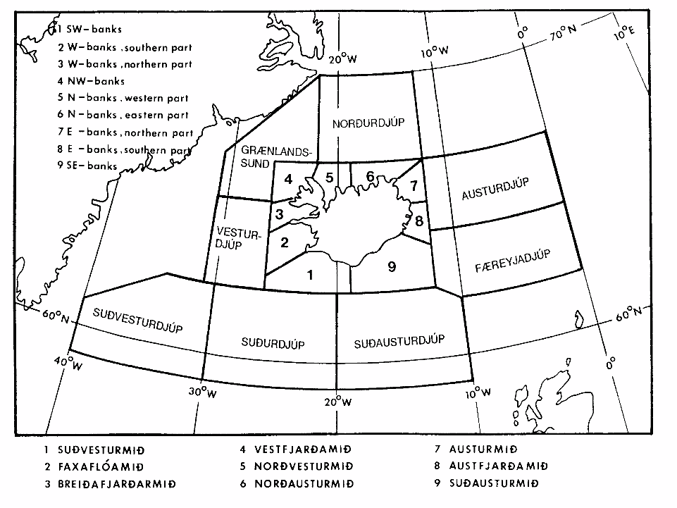
These areas are used by the Icelandic Met Service for use on the Internet and for NAVTEX broadcast from Reykjavik. The inner (numbered) areas are the Sea areas. The outer areas are the High seas Areas. |
This chart is shown courtesy of the Icelandic Met Service
Return to Home
