
Answer: When it is a deep extra-tropical depression. Use of the word hurricane is a cause of some confusion. This page clarifies the terminology.
The Beaufort Scale
By international agreement, winds can be described using the Beaufort scale. Winds of force 12 and above are called �Hurricane force 12,� or whatever number is used for stronger winds.
Hurricane, Typhoons and Tropical Cyclones
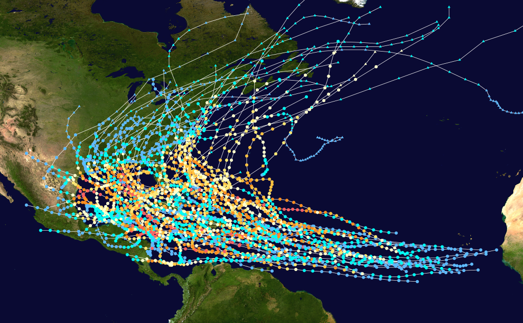
Meteorologically, these re the same kind of storm. The name depends on the area in which such storms occur. All are formed in low latitudes - around 10 degrees latitude from the equator. The main driver in these storms is latent heat from the tropical oceans. Atlantic hurricanes need sea temperatures > 26 degrees C over an area the size of the continental USA. They are often born near the cape Verde Islands. As they develop, they move from east to west usually curving towards the pole. That is shown well in this composite picture of hurricane tracks.
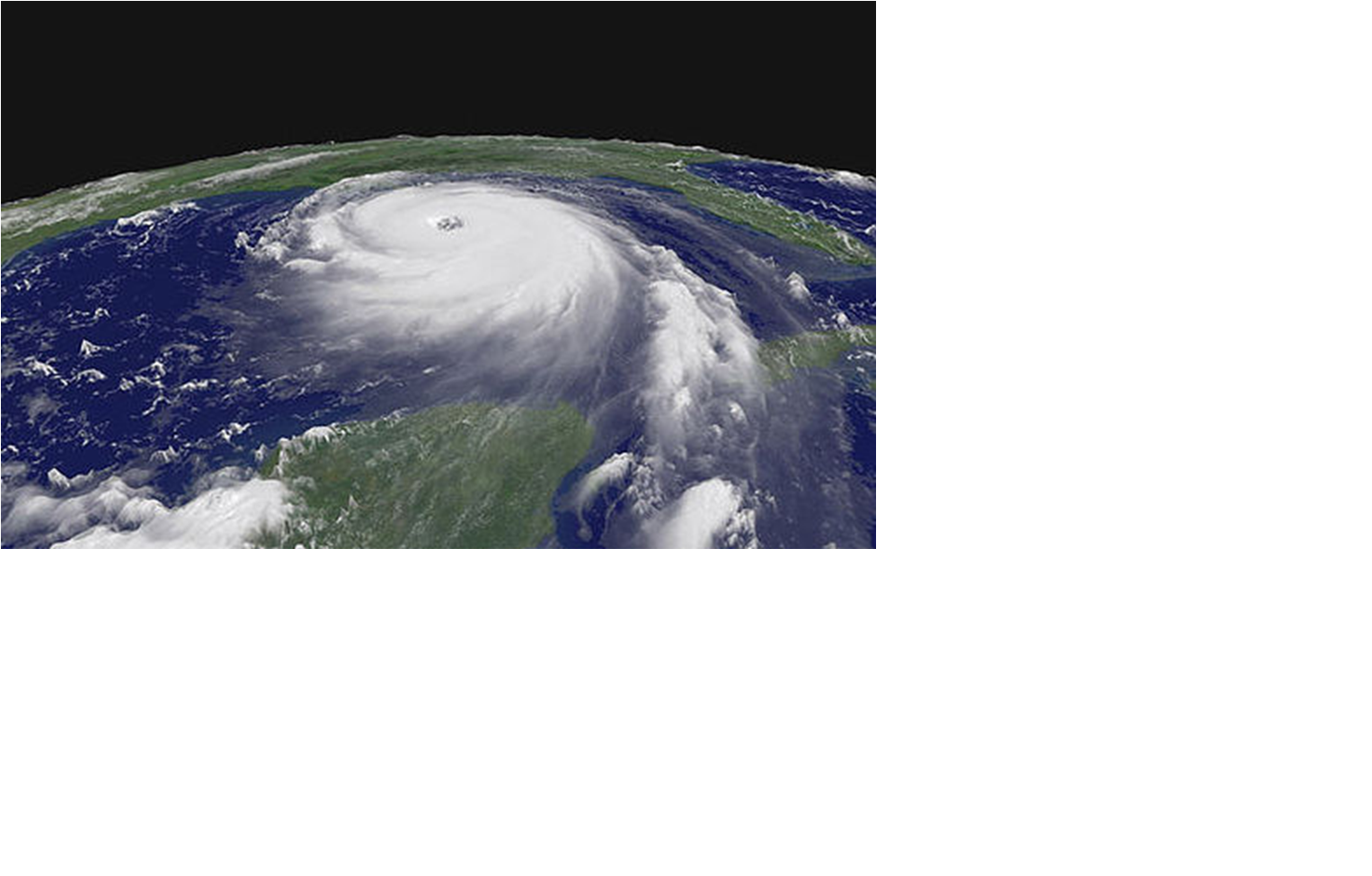
Enormous amounts of energy are required to drive a typical hurricane. It has been estimated that it takes the equivalent of 8 H-bombs an hour. Hurricanes look like this
As we all know, winds can be very strong. The terminology applied to all tropical depressions is shown here -
|
TERM |
Maximum Wind Force |
|
Tropical Depression |
Force 7 or less |
|
Tropical Storm |
Force 8 or 9 |
|
Severe Tropical Storm |
Force 10 or 11 |
|
Hurricane/Typhoon/Tropcal Cyclone |
Force 12 or more |
|
Tropical storm descriptions | |
Hurricanes are seasonal phenomena as shown in this table -
|
Type of Storm |
Minimum |
Average |
Maximum |
|
All Tropical Storms |
4 |
10 |
19 |
|
Those becoming Hurricane |
2 |
6 |
12 |
|
Typical numbers of storms (ie tropical depressions with F 8 or more) | |||
Because they depend on sea temperatures, there is a marked seasonal variation, This leads to the old and not too precise rhyme:-
June � too soon.
July � stand by!
August � look out you must.
September � remember.
October � all over.
|
May |
June |
July |
Aug |
Sep |
Oct |
Nov |
Dec |
|
0.1 |
<1 |
<1 |
2-3 |
3-4 |
2-3 |
<1 |
0.1 |
|
Seasonal distribution of North Atlantic Tropical Storms | |||||||
Extra-tropical or temperate latitude storms
These form on the polar front, the boundary between air from Polar Regions and the tropics. They go through a fairly well defined life cycle as described in textbooks. The formation, development and decay of these lows are associated with distortions of the jet stream. This is a textbook sequence of a developing extra tropical depression.
|
A wave is just forming. The jet stream, shown in yellow, is showing a slight bend 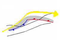 |
Becoming more pronounced as the jet stream develops a bend 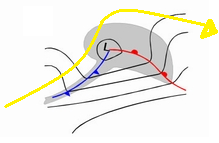 |
Now mature and starting to occlude as the jet stream becomes more distorted 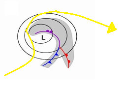 |
This low is now decaying. The jet stream has reformed to the south 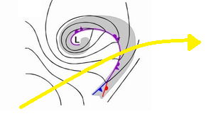 |
The satellite image below is of the October 1987 storm that devastated large areas of the southern England and northern France. Winds reached hurricane force 12. However, clearly it was not a hurricane. It was not well forecast, although it was, in fact, a near miss. Mike Fish was quite correct in saying that it was not a hurricane although, as he said, winds would be very strong.
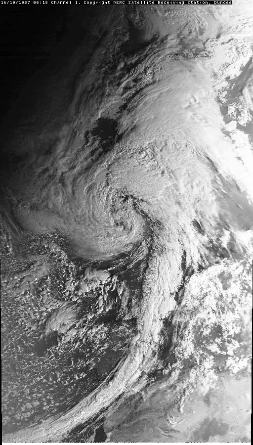
By courtesy of the Dundee Satellite Receiving Station, University of Dundee, UK.
Return to Home Page