
Updated November 2023. Apps come and go. I do not guarantee that all these links are active.
What this page is about
This page is based largely on my experience testing Apps on an iPad and laptop. Mostly, these are “work in progress” and this page will inevitably lag behind events. The original emphasis was is on apps that are free to use. Some that are commercial are now included. I have included some links to web pages that give access to weather information derived from GRIBs.
Introduction
To many, GRIB Apps are, effectively Tablet or Smartphone versions of the File Transfer Protocol system used by such as XyGrib.. For those with long memories, XyGrib is a greatly improved service developed put of the now unsupported zyGrib. In this page, I include other ways of viewing GRIB data.
In most cases there is a small charge for the App but most are free to use – except, of course, for communications costs. Some of these apps are loss leaders for commercial services.
Weather models
Initially, the main source was the NOAA, NCEP GFS (Global Forecast System.) This is still the most widely used model. A wide range of weather elements is available. The GFS uses a 13 km grid (about 1/8 of a degree but issues the data on a 0.25 degree grid – about 25 km. Data from the USN COAMPS model (Coupled Ocean/Atmosphere Mesoscale Prediction System) has long been available also. However, with the continued decrease in global model resolution, COAMPS has become less relevant. Effectively it is now just another source of forecasts.
Times are, inevitably, changing. More forecast centres are making their data available, sometimes free, sometimes at a premium. Policy is usually determined by governments rather than the forecast centres. In addition to the USA, Canada, Germany and France now make their model data freely available. A comprehensive listing of and links to NWP output from national centres will be seen on the Meteociel site.
Coding for some NWP models is available and, with increasing computer power, some private, as opposed to government institutions are now running models. Most run fine resolution models, usually the WRF. To the best of my knowledge, no private weather firm starts with a detailed data analysis. I discuss the advantages of detailed, LAMs (Limited Area Models) and LAMs in general? on other pages.
Wave and current models
There are both WW3 and FNMOC wave forecasts available. Some are for specific areas such as the Mediterranean. Current predictions may be available for inshore areas as well as oceans.
CAPE
All the elements on offer are obvious except, perhaps for CAPE. This is an index of instability and indicates thunderstorm or lightning risk. There are other parameters, CIN, SRH, Reflectivity used my professional meteorologists and available on some GRIB services. My advice at present is to use CAPE in areas where showers are expected or there is a cold front or occlusion.
Length of forecast
The GFS runs out to 16 days with the first 10 days being output on a 0.25 degree grid. After 10 days, data are only available on a 2.5 degree grid and 12 hourly. Skill decreases rapidly after7 days so that it is unwise to make plans beyond 6 or 7 days ahead. I find it useful to monitor forecasts out to 10 days on a rolling basis to see early signs of consistency between successive runs of a model.
List of Apps on this page
Some of these Apps piggy-back on the Saildocs service. Mostly, they are all the same data albeit with different presentations and some variation in the selection of elements, sea state and current.
NOTE
For weather, few give more information than Saildocs. Most give less either in number of days or resolution or both. Most Apps interpolate between the GFS grid point values making it appear that they are providing more information.
On a laptop
For iPad
For iPad and Android
For Android
For iPad, Android and Windows
For all platforms
Examples of iPad, images will be similar to those on iPhones and are taken from my iPad. Android examples are taken from the relevant sites.
XyGrib
This is described in detail at XyGrib FTP service. There is a wide range of global and limited area models, GFS, DWD ICON, Metéo France ARPEGE global models, ICON-EU, ARPEGE-EU, NAM USA, NAM Caribbean, NAM Hawaii regional models and the high resolution Metéo France AROME.
Weathertrack
iPad

Weathertrack has a wide, one of the widest choice of options.
Elements -
Wind, Pressure, CAPE, Rain, Snow, Dew point, Cloud Cover, Waves (Height/Direction/Period, ), Currents, Air- and Sea Temperature, Relative Humidity.
Forecasts are up to 20 days (depending on the model), Choice of ,models GFS, COAMPS; severs wave models including for the Mediterranean.
In addition to GRIB data, there are many other options including synoptic charts, weather actuals and much more. It is nearly a one-stop forecast service.
Two slight drawbacks. First, the chart projection is distorted in northern latitudes, Secondly, pressure and wind apart, it is impossible to overlay elements. Charts look like this
|
Winds  |
Waves  |
Currents  |
Basic price Ł9.99, extras include tides.
iNavX
iPad & Android
This is a free facility of the well-known iNavX navigation package.
Elements available – T Wind, Air and Sea temperature, Wave height, Precipitation.
These are chosen separately and the software generates an email for each to Saildocs. The reply email should arrive within one minute with an attachment that can be opened with whatever GRIB software you have - including overlaying on the navigation chart..
This is a rather simple, somewhat clumsy service that, by default, gives information over a 20 degree lat/lon area covering the area currently in use on your iPad screen..
Forecast periods can be chosen up to 7 days from the GFS and COAMPS. With a little care it is possible to edit the email to change the times, elements requested and the default area. See my Saildocs page. Deleting the words “sent from mu iPad” will avoid annoying failure messages.
Displays on the iNavx charts look like -
|
Winds  |
Waves  |
Included in the cost of the navigation app.
Weather4D
|
iPad  |
iPad  |
|
iPad  |
Android  |
Weather4D is another with a wide choice of options. It also has the option of using email to Saildocs. for use when bandwidth is limited. This is a most useful facility as the file can be opened with other viewers. This includes th iNavX chart plotter App.
Elements –
Wind, Pressure, Cloud, Precipitation, Air temperature, CAPE, Waves (Height/period/direction). Currents
Forecasts up to 10 days (depending on data model), Choice of ,models GFS, GEN, COAMPS, WRF. For waves there are WW3 Global and European Wave models. There are My Ocean global, Biscay and Mediterranean current models.
Elements can be overlaid although it can be difficult to view. A particularly nice feature is the presentation of a time sequence of wind speed and direction overlaid on the charts of wind. Displays can be animated. These are some samples -
|
Baltic winds  |
Winds & Isobars 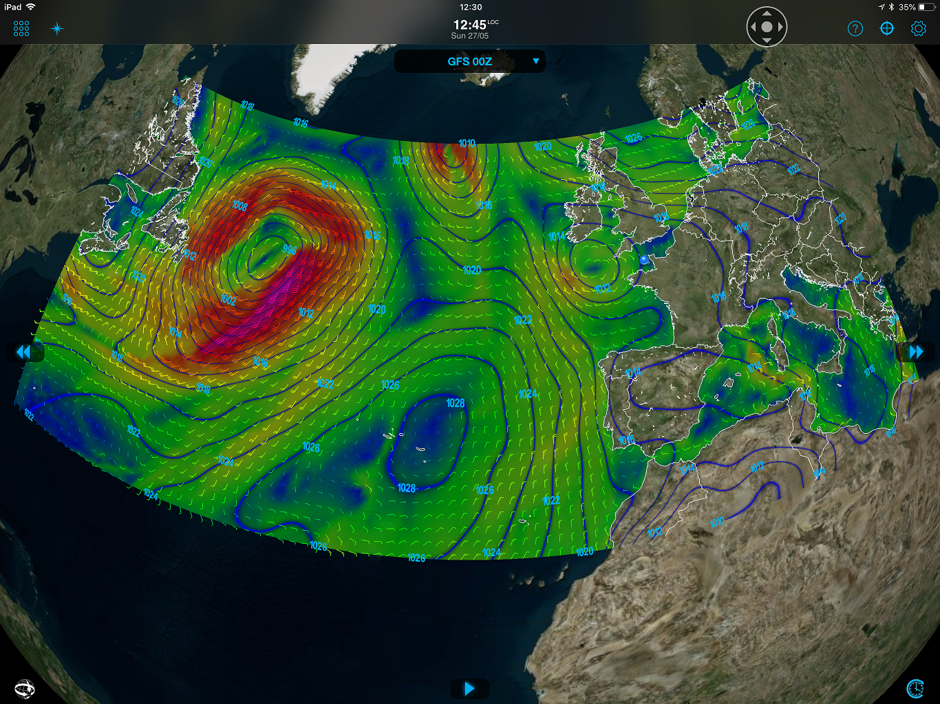 |
Waves  |
Meteogram 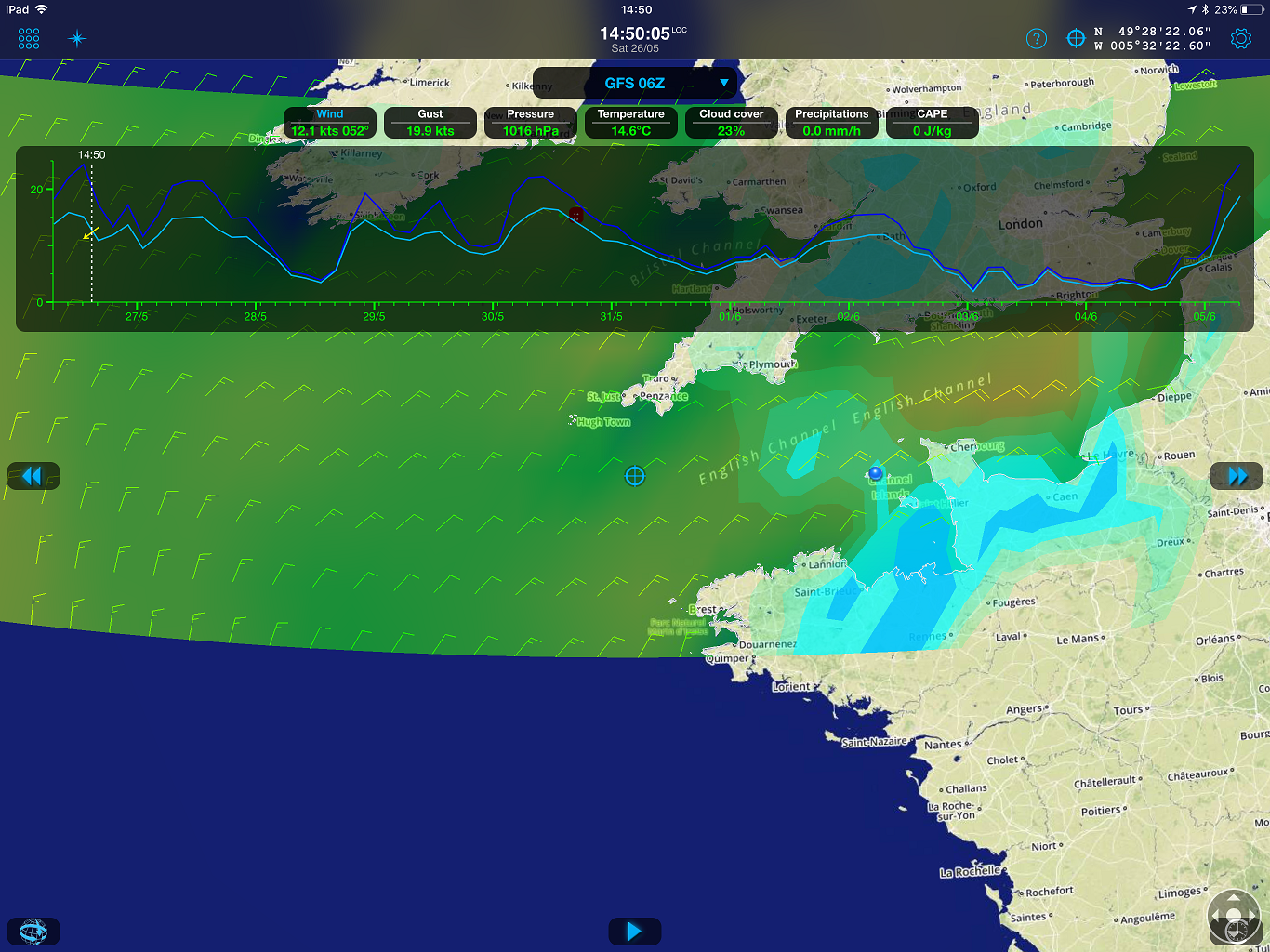 |
Basic (Lite) version Ł14.99. Routing and Navigation routeing versions also available.
PocketGrib
|
iPad  |
Android |
This has a fairly large range of elements. The chart projections are good with latitude/longitude lines. It does interpolate between grid point values giving a slightly misleading appearance of precision.
Elements -
Wind, Gusts, Precipitation, Pressure, Air temperature, Cloud, Relative humidity, CAPE, Waves (including Mediterranean and Black Sea,) Current (Atlantic only)
Forecasts up to 8 days from the GFS, COAMPS, WWŁ (including the Mediterranean.)
These are examples -
|
Winds, isobars, waves  |
Waves  |
Meteogram  |
Ventusky
iPad & Android

Like
- GFS output with a wide range of options
- DWD ICON global model 4 times a day with output at hourly intervals, although only for 3 days ahead.
- DWD ICON-EU updated every 3 hours. Available at about H+4.5
- Analyses for the past 7 days.
- Canadian GEM NWP.
- COSMO-DE, the DWD national area modelincludes the N Sea. Run 3-hourly, available at about H+2.
- US HRRR (High Resolution Rapid Refresh) updated hourly.
Examples of screen displays.
|
Wind display 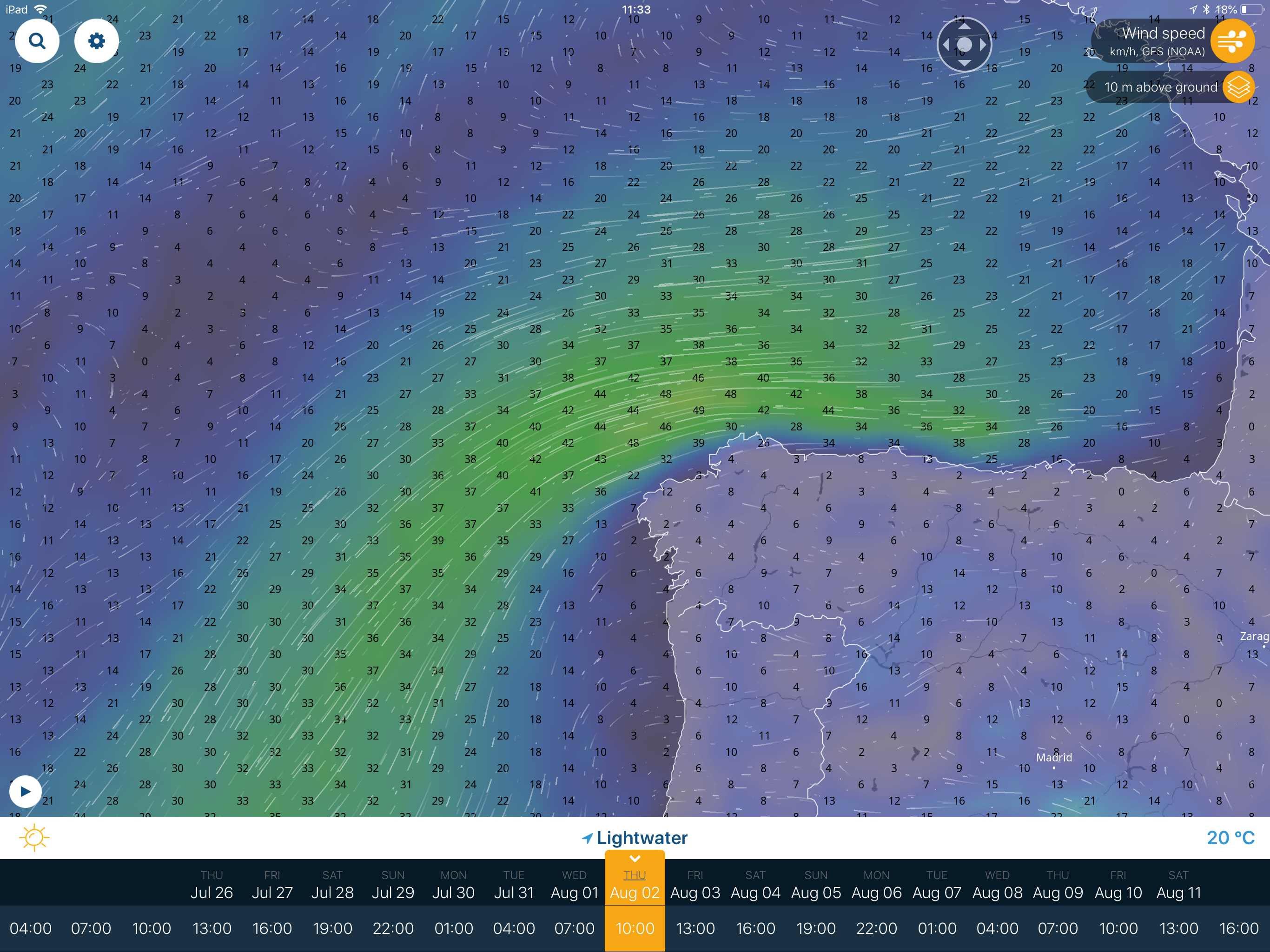 |
Element selection 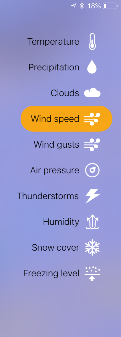 |
Model selection 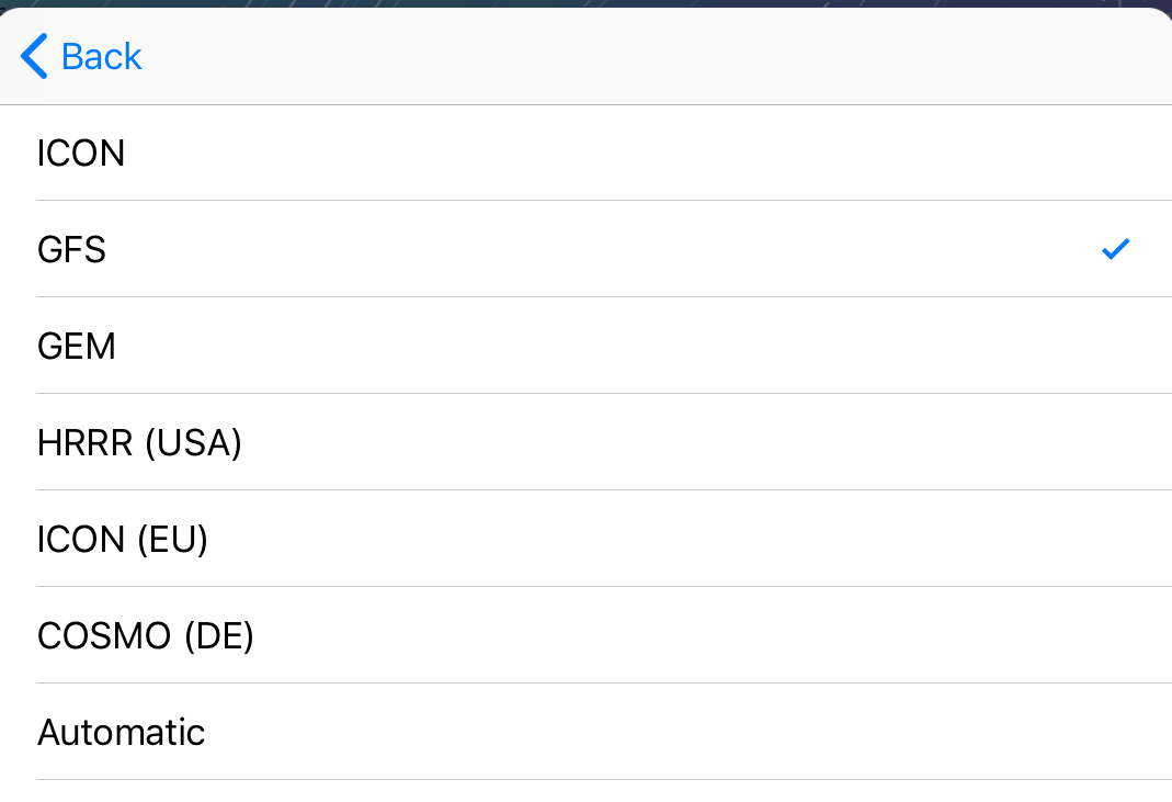 |
Thundertorm/CAPE 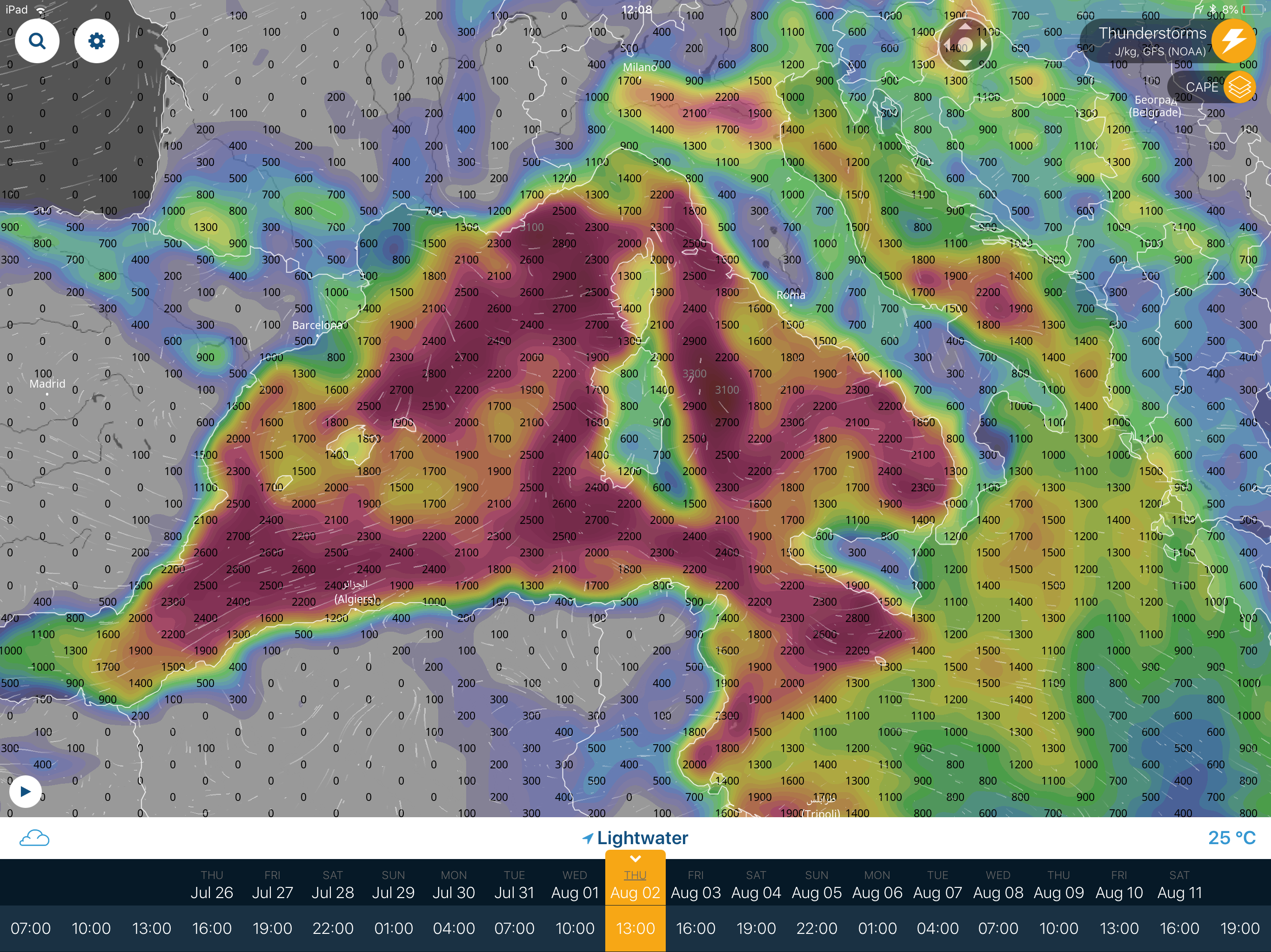 |
COSMO-DE 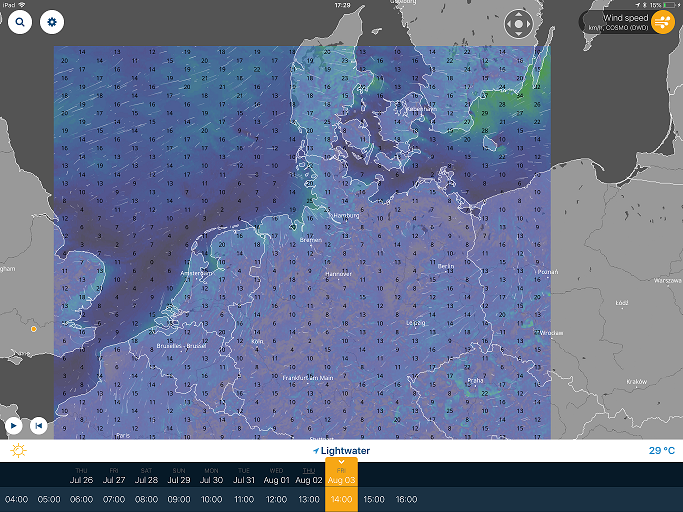 |
This is the only source known to me of readily available source of ICON-EU updated 3-hourly. The streamlines are not easy to see but show better on the browser version although I find the tablet app easier to use.
In 2018m the app cost Ł3.99. The browser version is free.
Windy.com
iPad & Android
Attach: Windy.png Δ
This Czech Republic site evolved from ideas developed by Meteoblue. Data are available worldwide so that downloads might be a little heavy. They provide –
- GFS output with a wide range of options
- ECMWF global model twices a day.
- DWD ICON-EU twice a day.
- NEMS, the US limited area model for Europe.
Examples of screen displays.
|
ECMWF winds over the North Sea  |
Element selection  |
Model selection 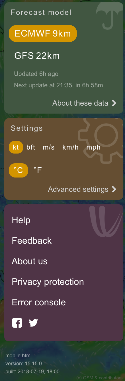 |
As far as I know, this is the only free source of ECMWF forecasts out to 10 days. The NEMS forecast is produced by Meteoblue and, if you like comparing models, an alternative to ICON-EU. However,
Predictwind
iPad & Android

This is a cut-down free version of their wide ranging commercial service.
|
Winds 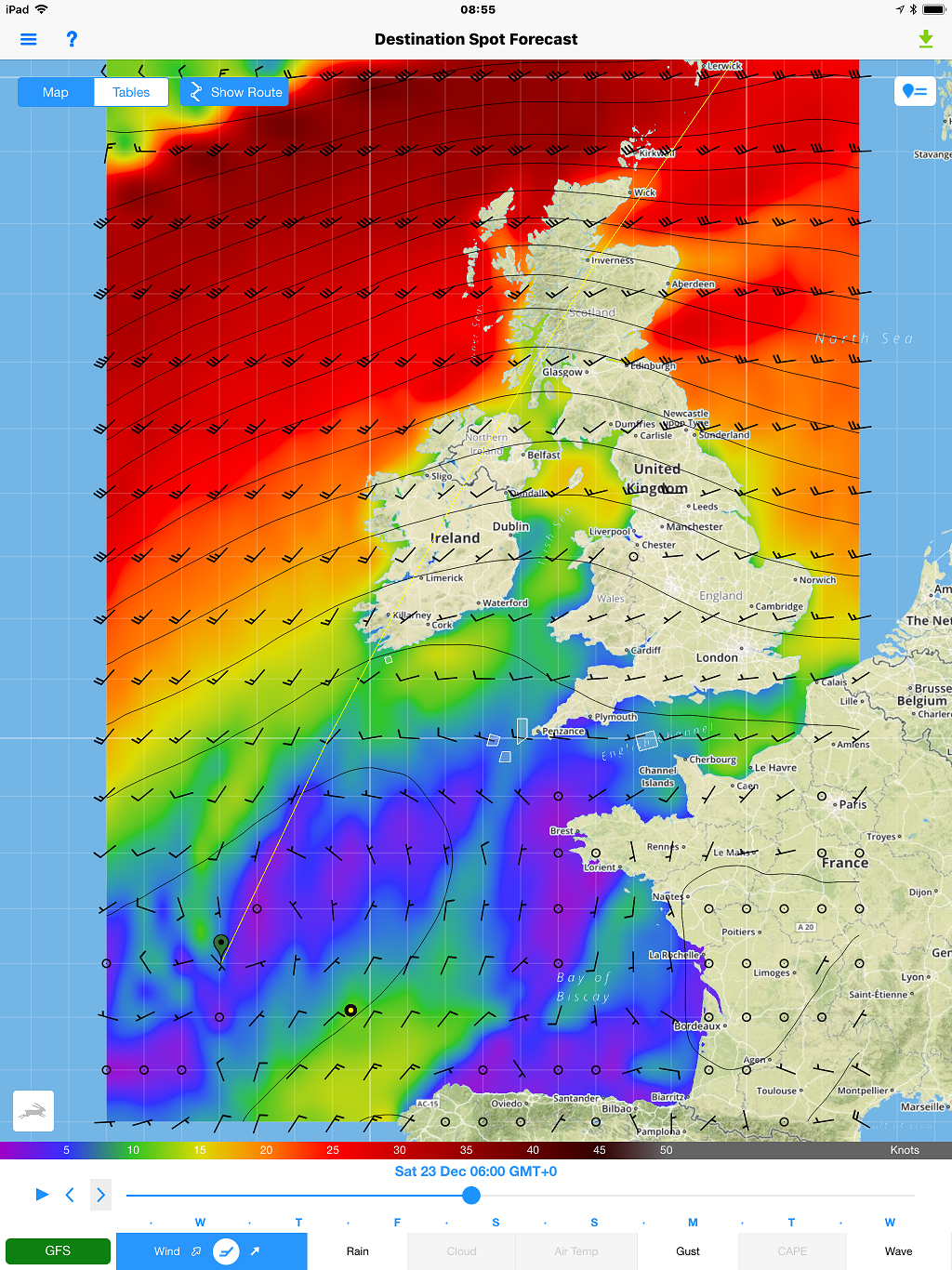 |
Model comparison 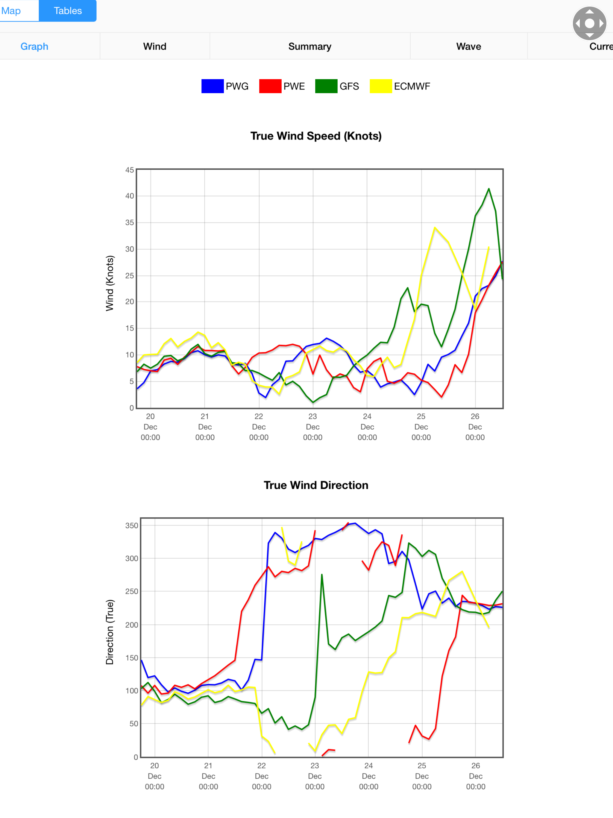 |
The Predictwind app has a weather routing capability. It also shows comparisons on a 50 km grid between their two “proprietary” models, PWG, PWE, the GFS, ECMWF, UK UM, Spire, HRRR, NAM, AROME It is (currently) the only free version of UK GRIB output. There is Spire, a model of unknown provenance run by a firm that has launched a constellation of micro satellites to measure radio occultation from Global Navigation Satellites.
Squid
iPad & Android
This is another cut-down free version advertising a commercial GRIB service.
|
Winds |
Meteogram 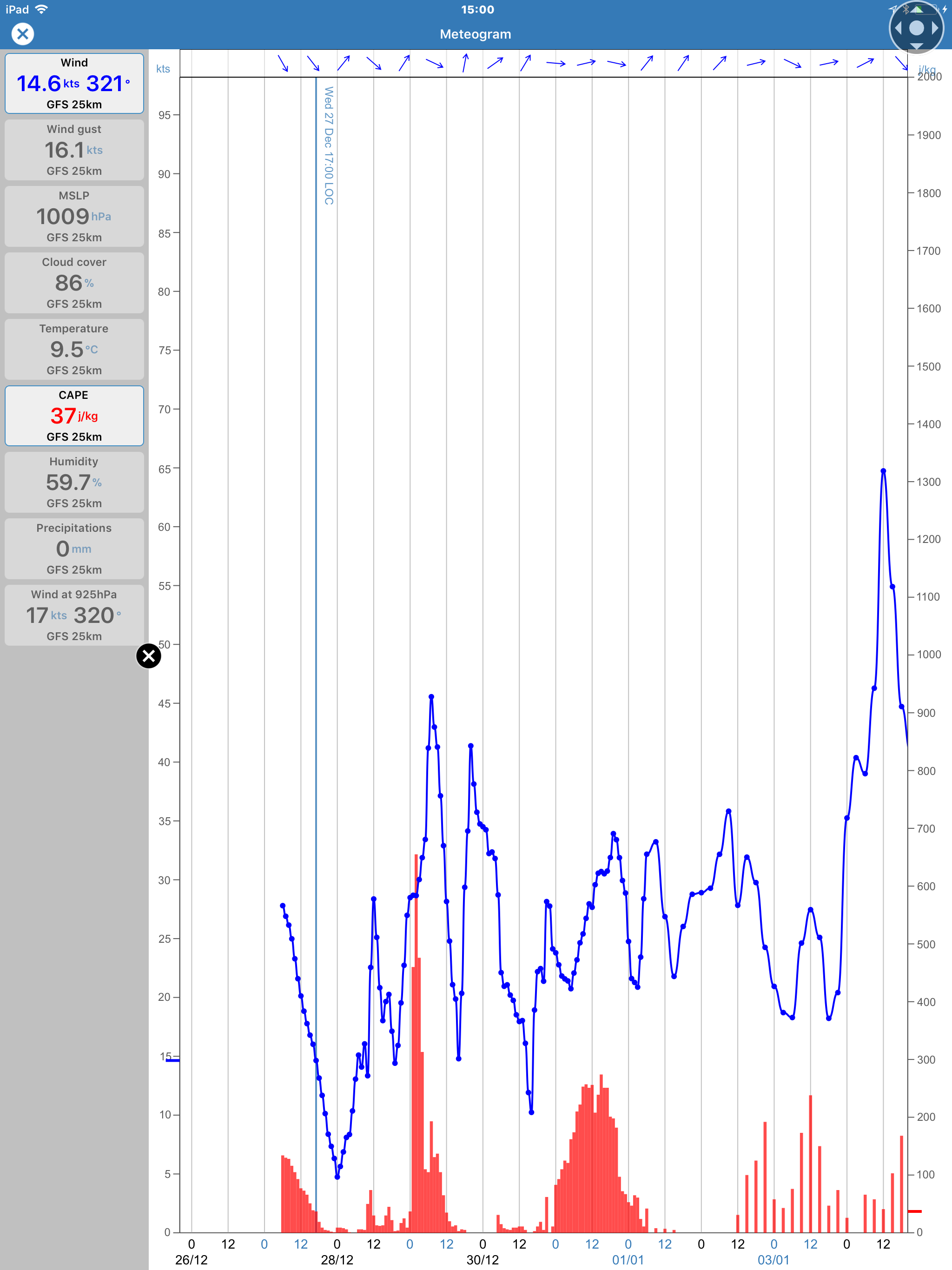 |

This app has a comprehensive meteogram facility, Squid also offers a routing facility.
Danish Met Service (DMI)
|
iPad  |
Android |
|
Index page 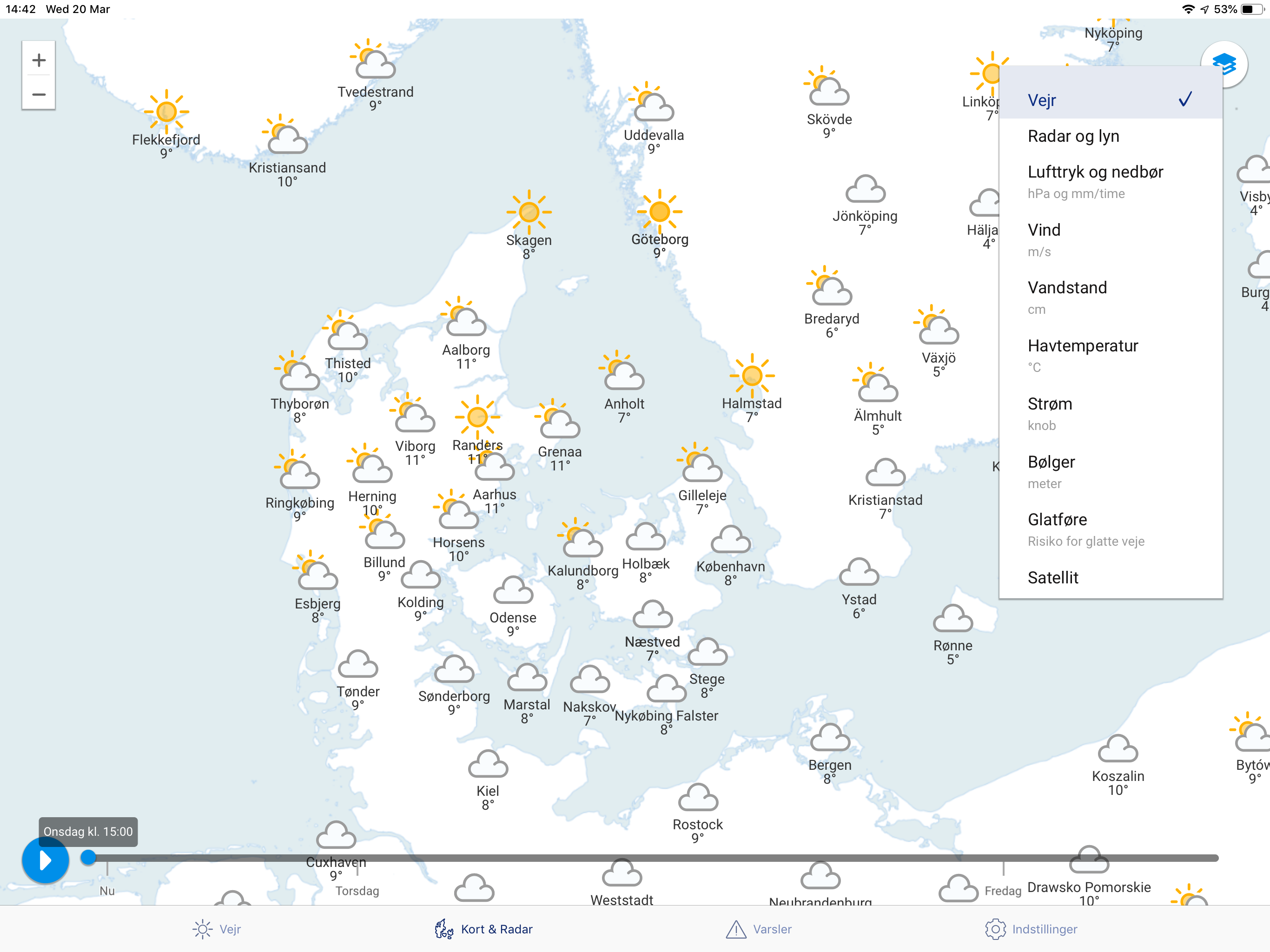 |
Area and Winds 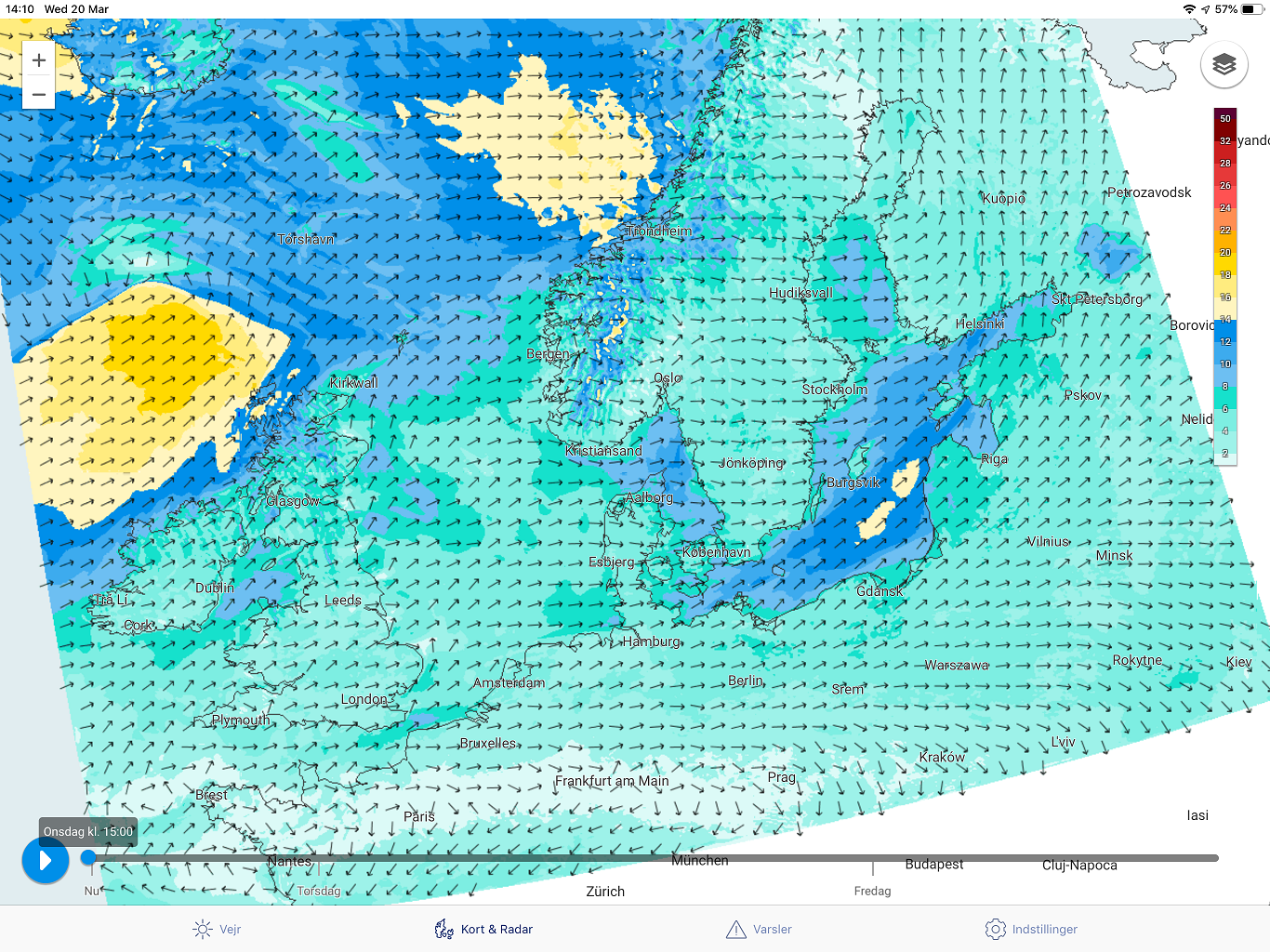 |
Swell 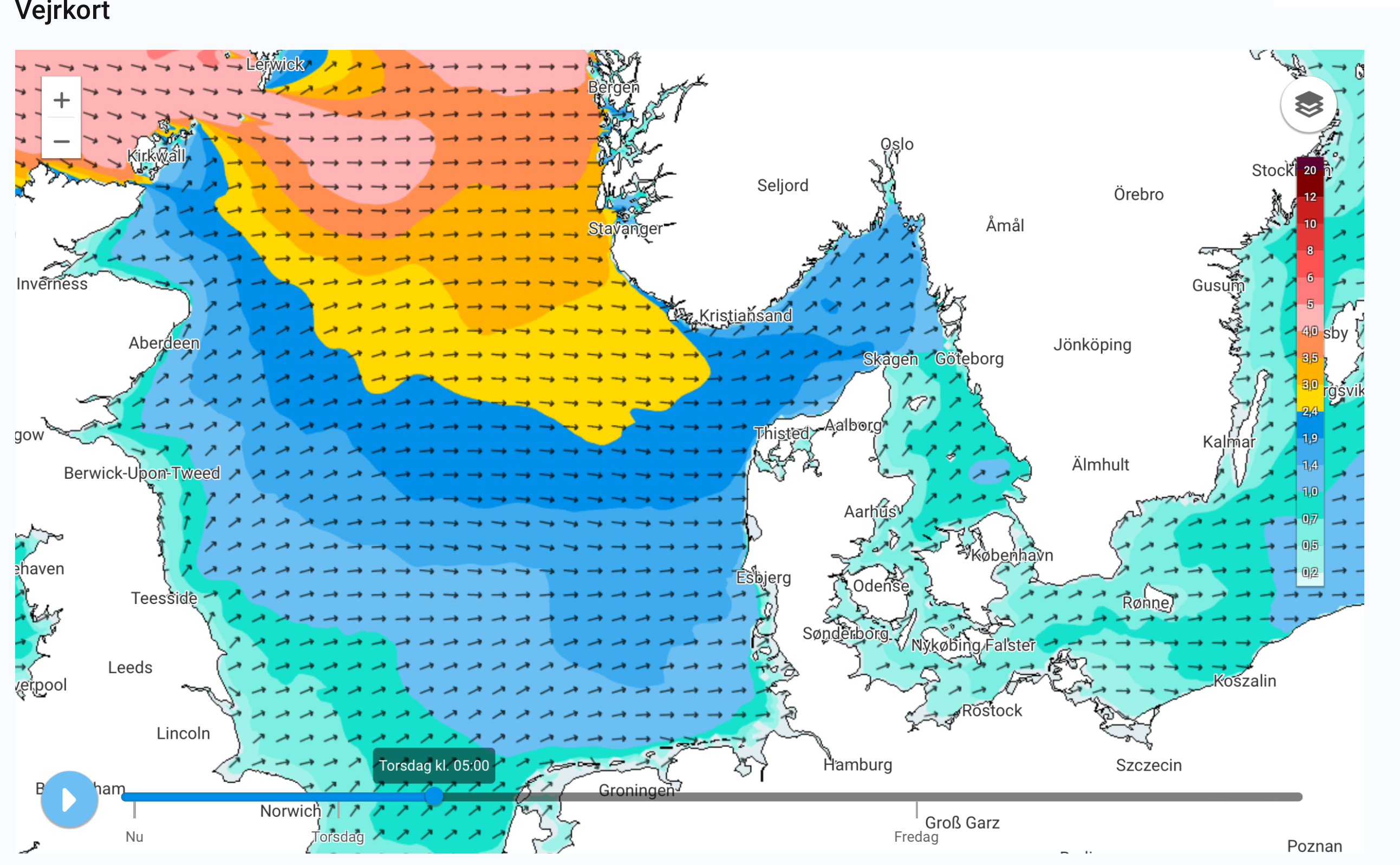 |
A useful app covering the North Sea, Baltic and English Channel using the HARMINIE LAM on a 2.5 km grid valid for two days. The information is available elsewhere but this is a particularly useful presentation of what is on their website.
Radar og lyn = forecasts of radar rainfall areas. I am not sure how they show lightning (lyn) unless it is just areas of the heaviest rainfall.
Vandstand = height of sea, particularly useful in the Baltic for the seiche effect.
Havtemperatur = sea temperature
Strřm = tidal stream.
Břlger – swell
Free.
mobileGRIB
Android

Not being an Android user, my knowledge of this App is limited to their site.
Elements
Wind, Pressure, Temperature, Cloud, Humidity, Precipitation, Waves.
Forecasts up to 16 days from the GFS.
These are examples -
|
Winds  |
Isobars  |
Rain  |
Price Ł4.16
SailGrib
Android
|
GRIB 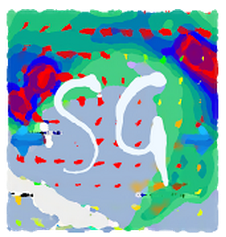 |
GRIB 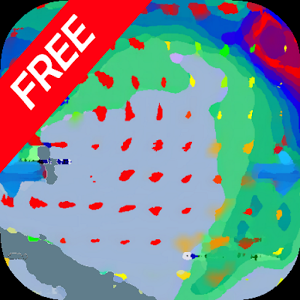 |
|
Route  |
Route  |
Unusually, there are free and on-payment versions. Forecasts for up to two days are in the free package. These can be upgraded for a small charge to full versions. There is a GRIB version and a Weather Routeing one.
Elements
Wind, Pressure, Precipitation, Cloud, Air Temperature, Wave (height/direction/period), CAPE, Tidal or oceanic currents
Depending upon the model forecasts are available up to 14 days ahead from the GFS, COAMPS and WW3 wave model.
SailGrib offers a variety of presentation formats to suit most tastes. These are some examples -
|
Winds & isobars  |
Enhanced wind display  |
Saildocs request panel  |
Prices for full versions - Ł7.99 and Ł45.99 for the routing app
ECMWF

This is a page of many outputs from the European Centre for Medium-range Weather Forecasts. There is much useful information, 10-day forecasts of isobars, winds, rain, CAPE, several sea state, sea surface temperate and much more. There are probability charts of 10 m gusts and displays of ensembles. Some charts will be incomprehensible to the average sailor.
|
Menu 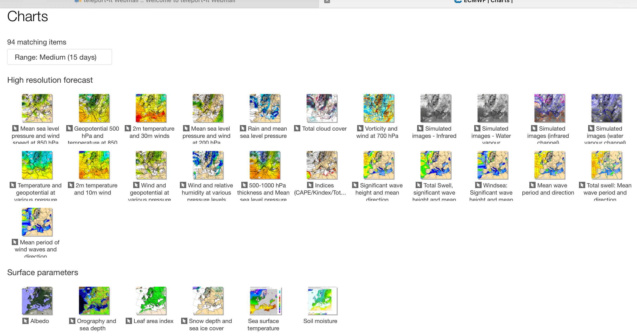 |
Surface temperature and wind 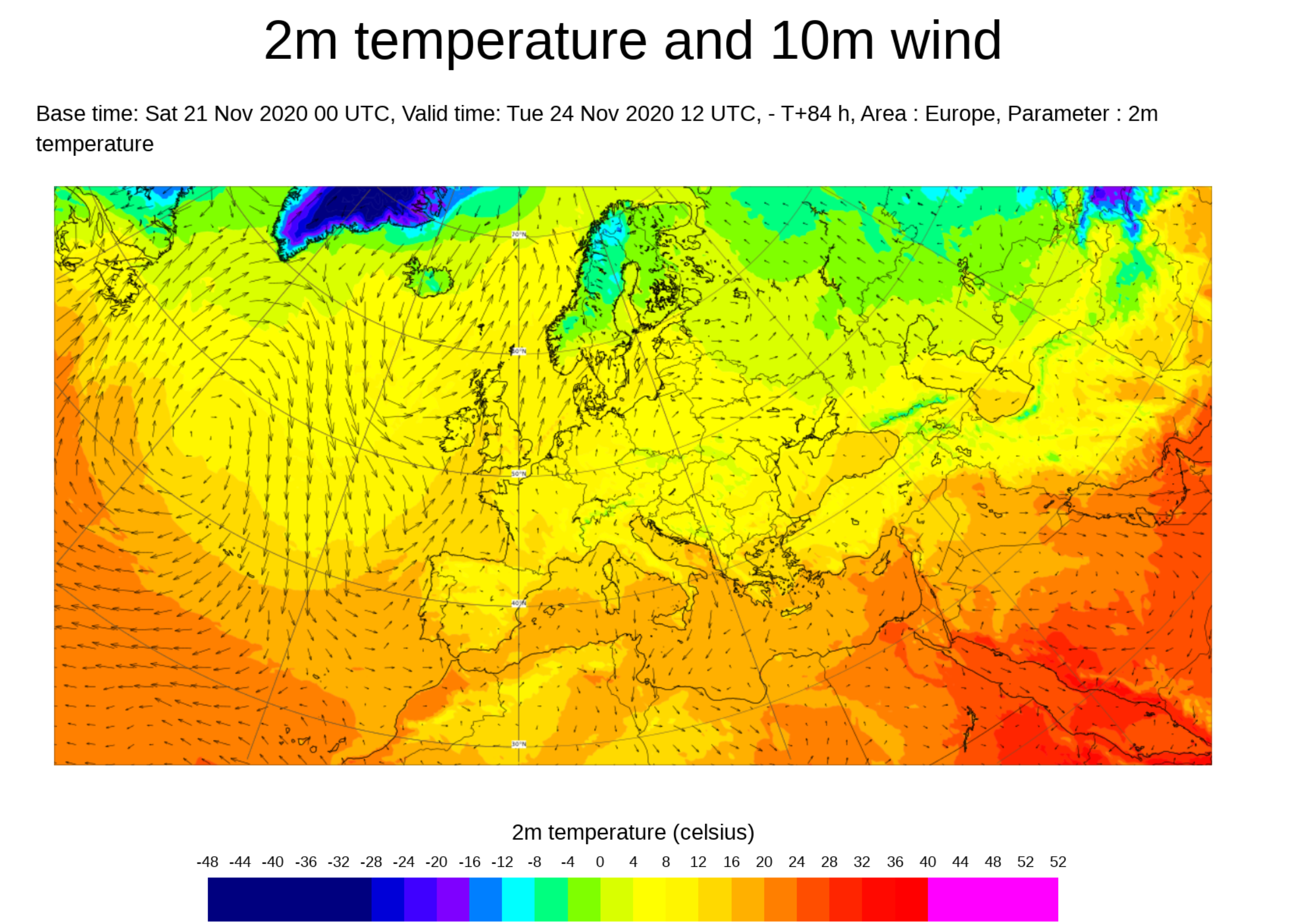 |
Significant wave 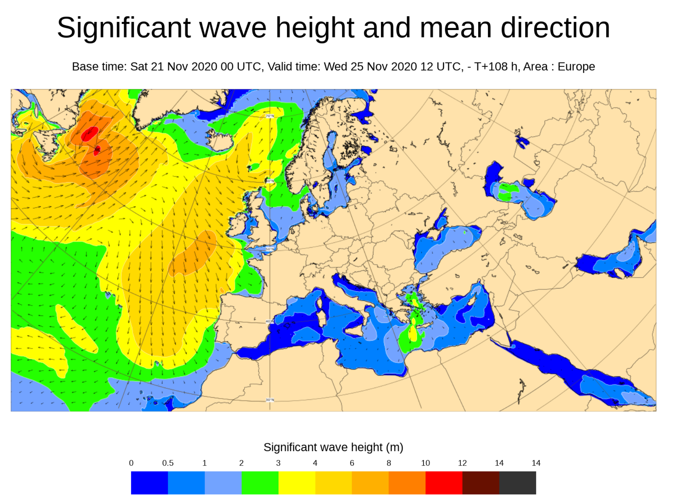 |
Rain areas 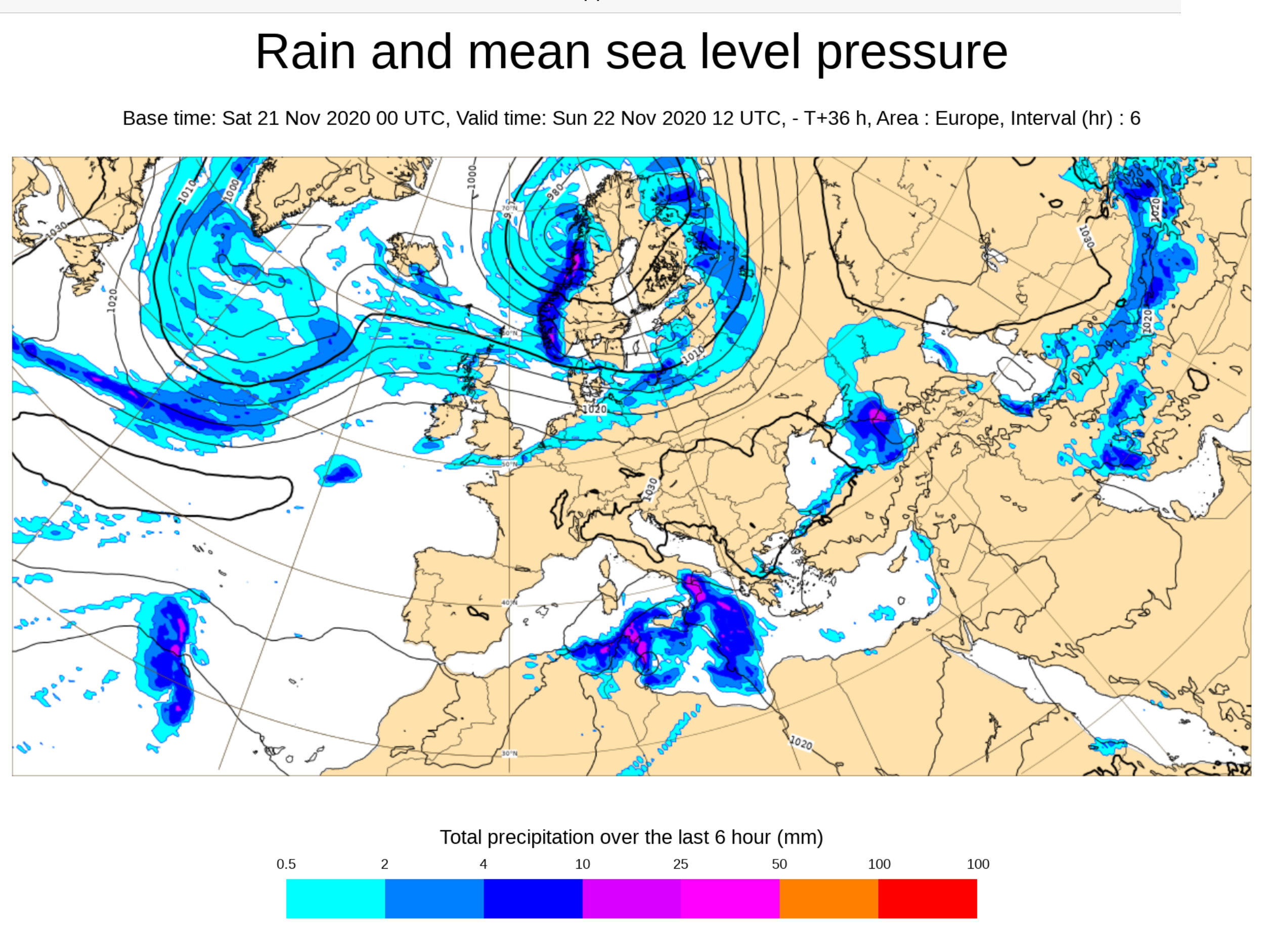 |
Ensemble values 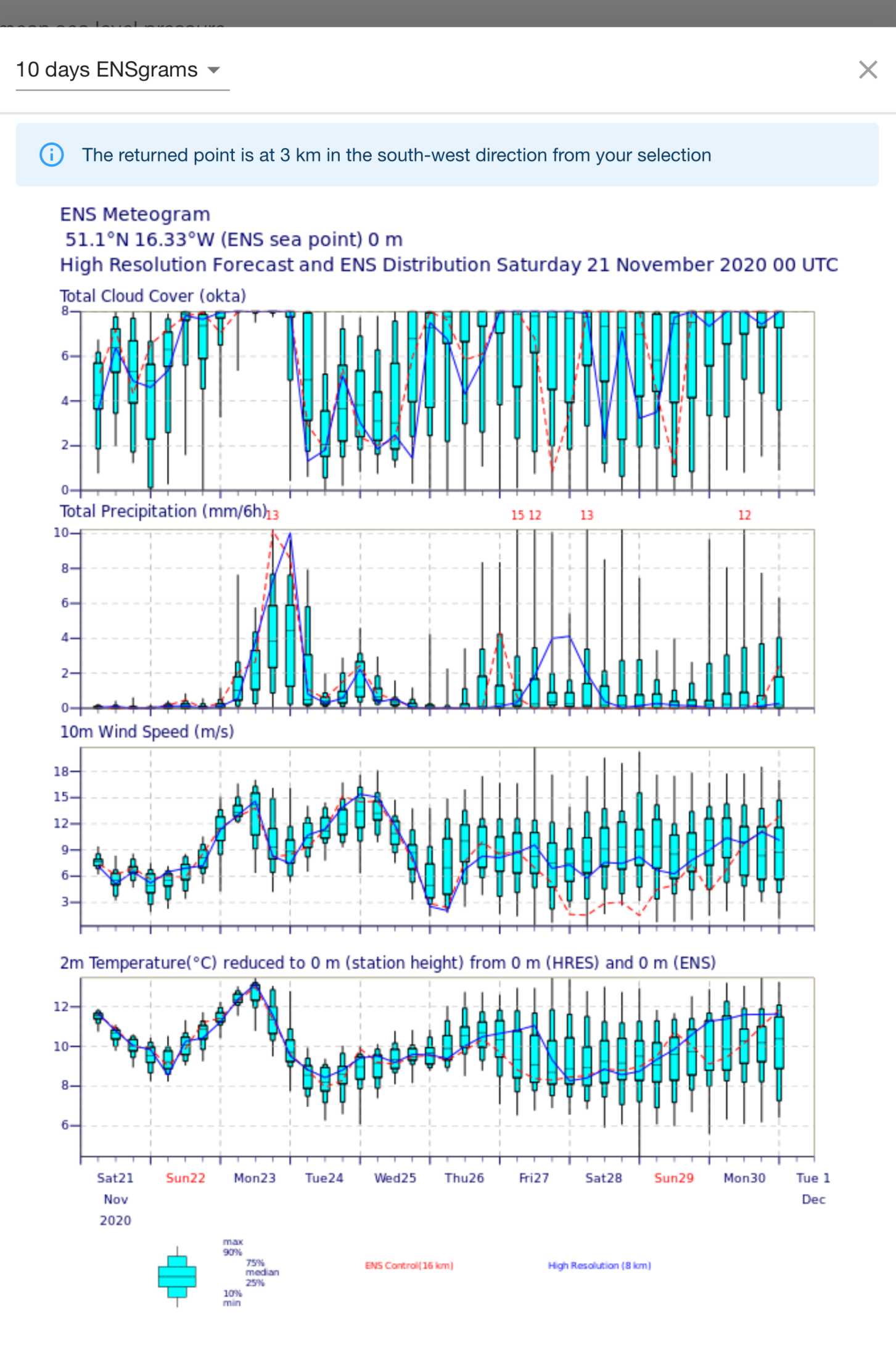 |
Tapping on these charts at any location gives a display of values and the spread from the 50 member ensemble. An example is shown here.
Meteoconsult
These are high resolution GRIB files from Meteoconsult. They are probably the WRF. Like all “non-official” limited area models, they do not use detailed data but start by interpolating from a global model.
|
Area selection 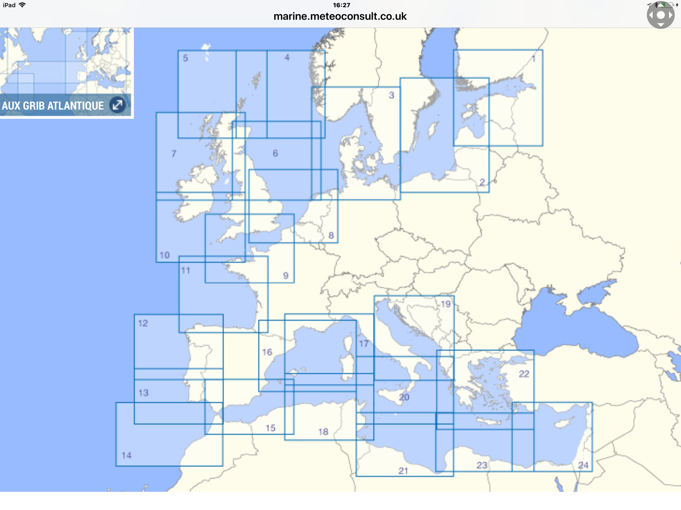 |
PocketGrib view  |
Weather4D view 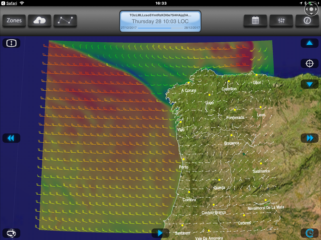 |
iNavX view 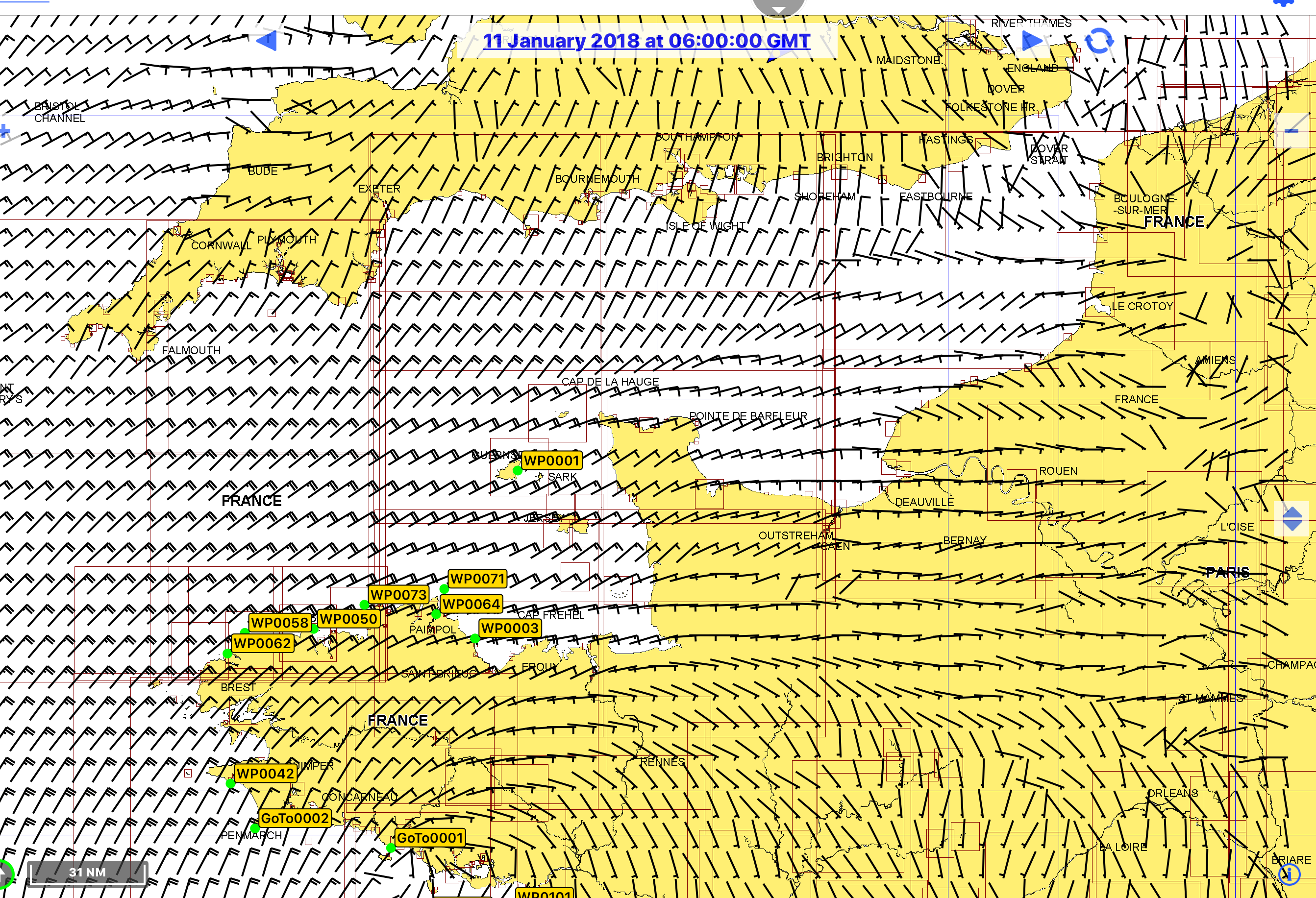 |
The file should open in any .grb viewer. This shows the selection panel with the ame file viewd using Pocket Grib and Weather4D.
Passageweather
Many will have used PassageWeather as an easy way to get vector wind charts from the GFS and other models. There is now a mobile version.which can be used with most platforms.
Area selection is from a list that mirrors the chart on the main website. Chart selection similarly. It can also be used on a PC without all the advertising blurb.
Examples are shown here -
|
Select area  |
Select chart  |
GFS Chart  |
Other Apps
There are websites which are, effectively apps and which sailors use.
Windfinder
As well as specific location forecasts they have a global (GFS) display and a “Superforecast”, an unspecified higher resolution WRF at hourly intervals.
|
Superforecast 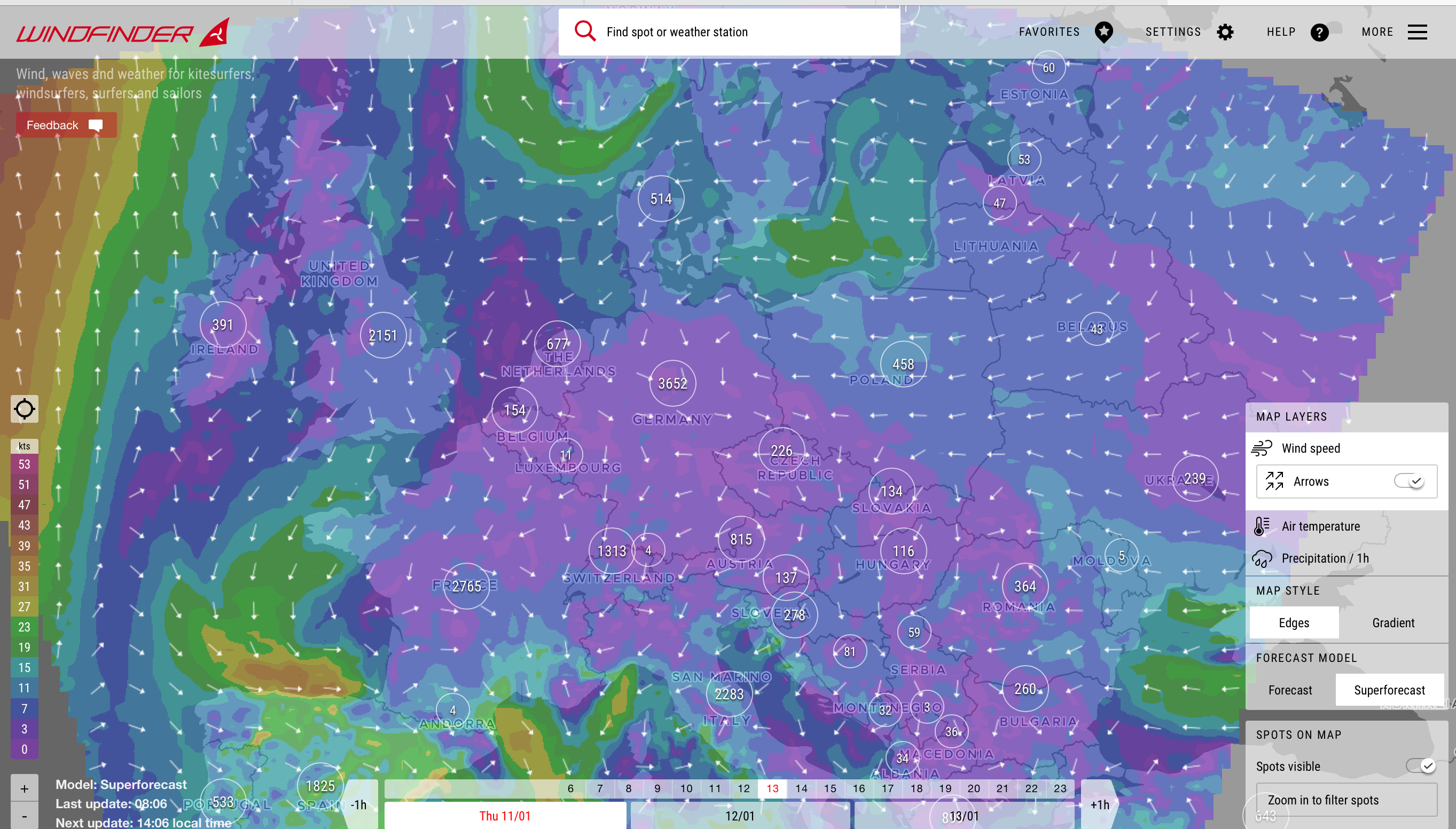 |
XCWeather
GFS outpu for pre-selected areas. A good source of latest observations. GFS forecasts only. Much used by sailors.
|
XC Forecast 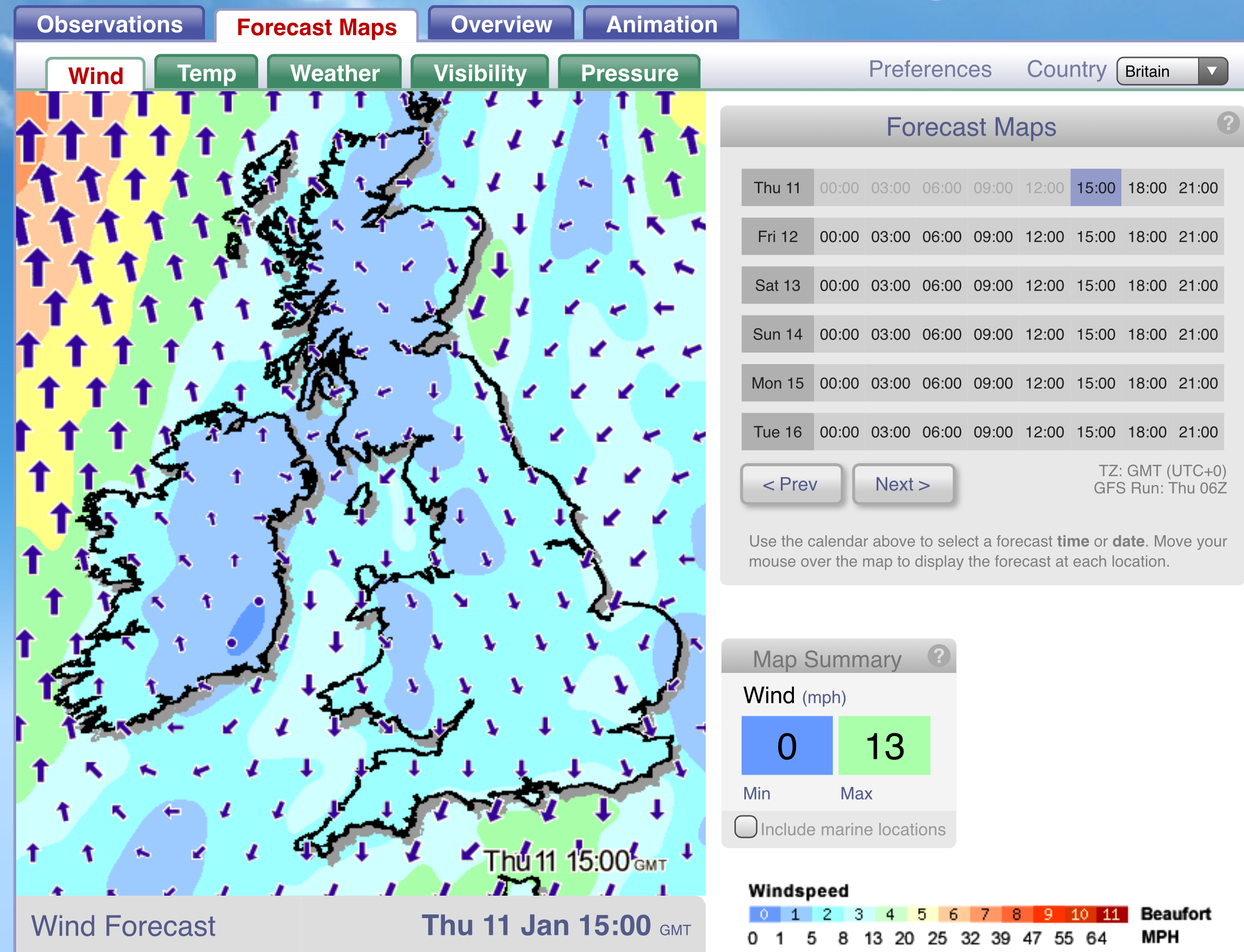 |
Meteociel
French/European oriented but still one of the most comprehensive of all weather sites. Output from most recognised models including WRF – usually with no detailed data input but also HIRLAM, Harmonie, Alaro , MeteoFrance and DWD (German Met service) detailed forecasts starting with detailed data analyses. Radar, lightning and satellite images. A good source of observations.
|
GFS  |
HIRLAM 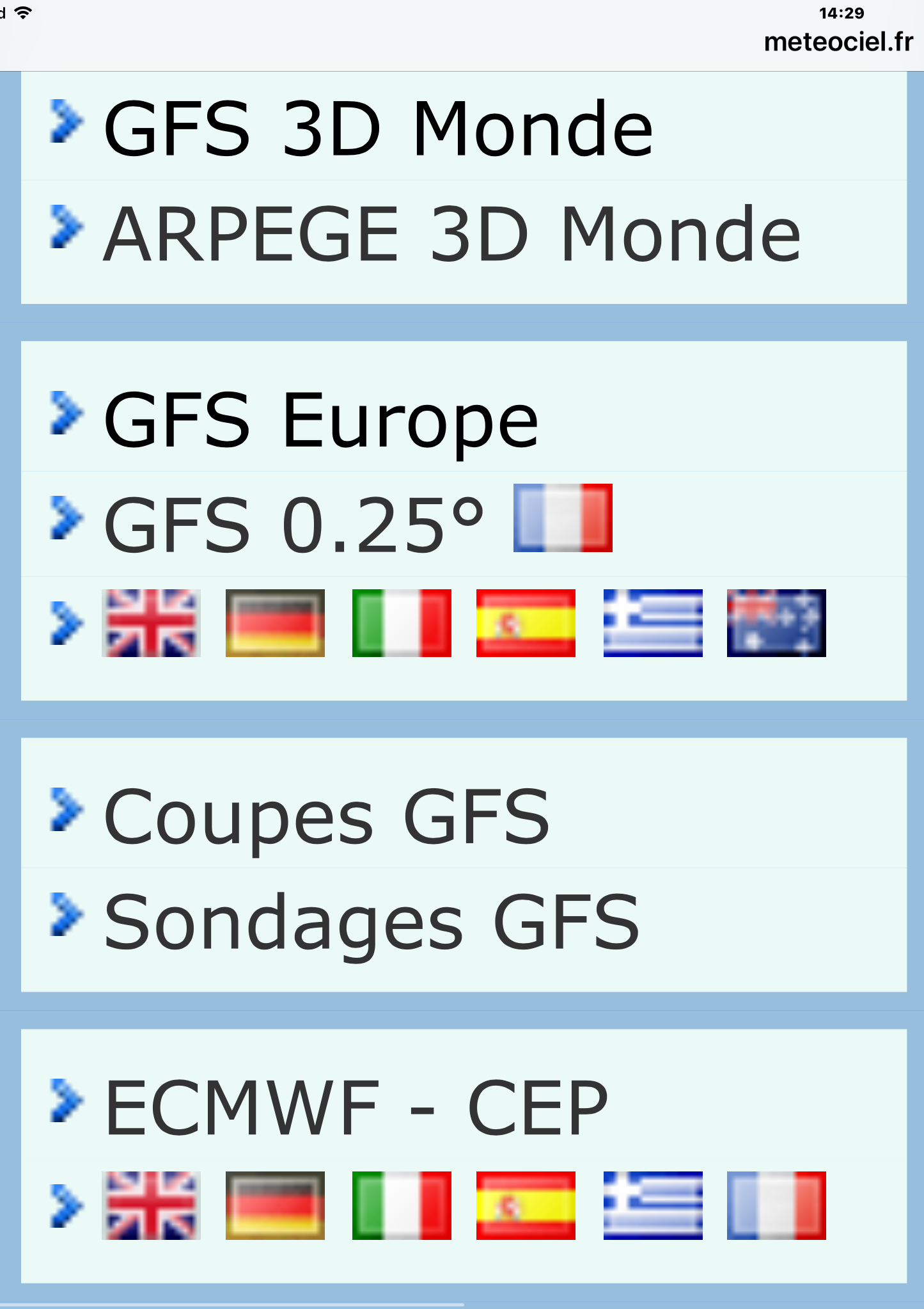 |
Global 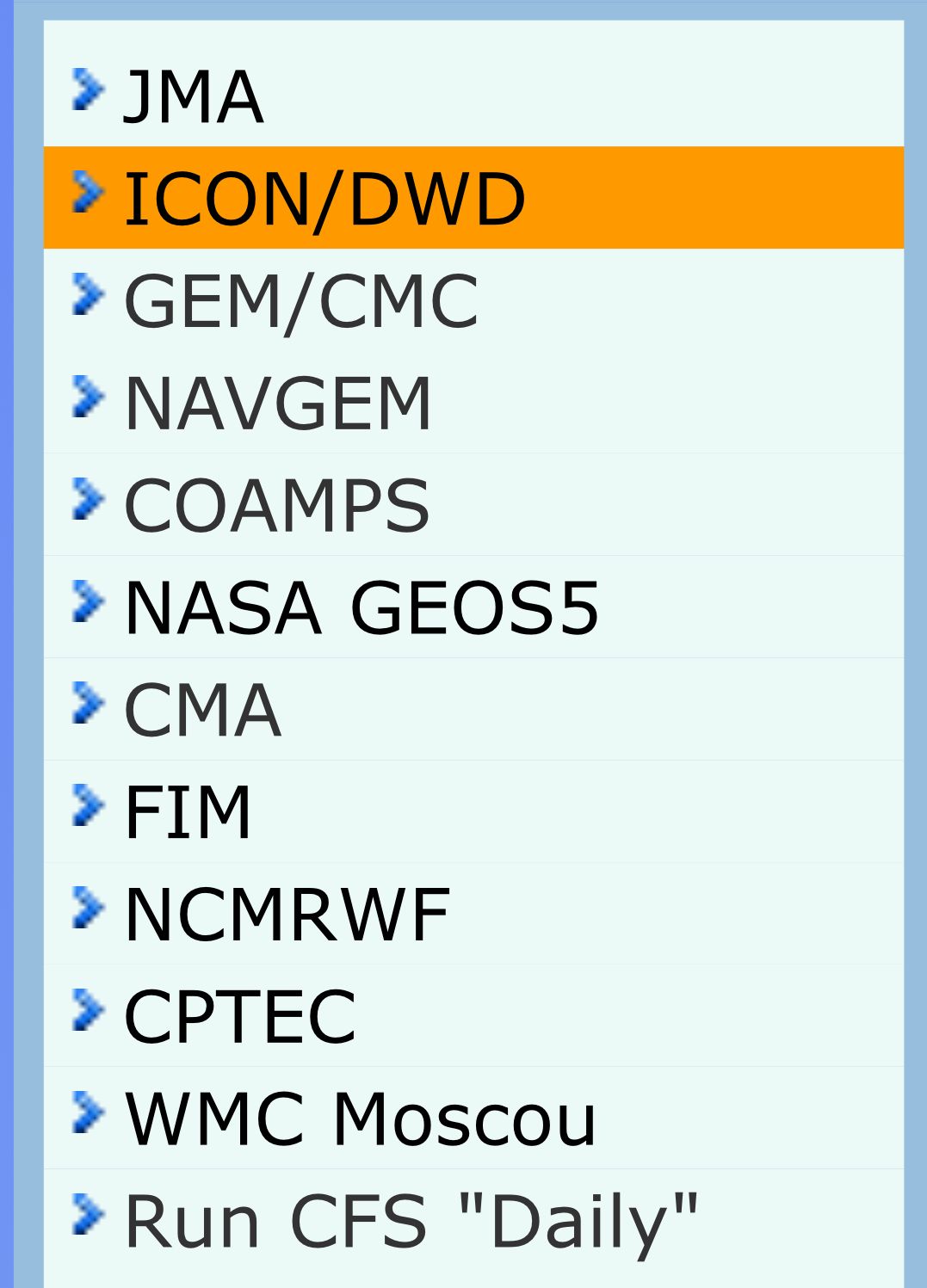 |
|
WRF etc 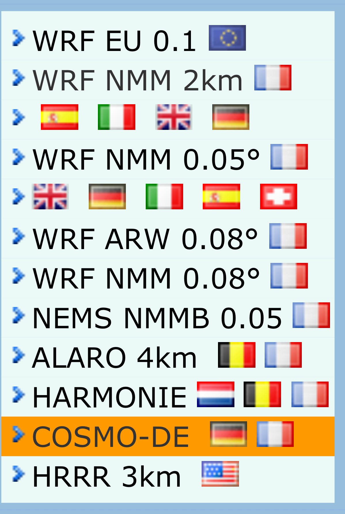 |
Ensemble 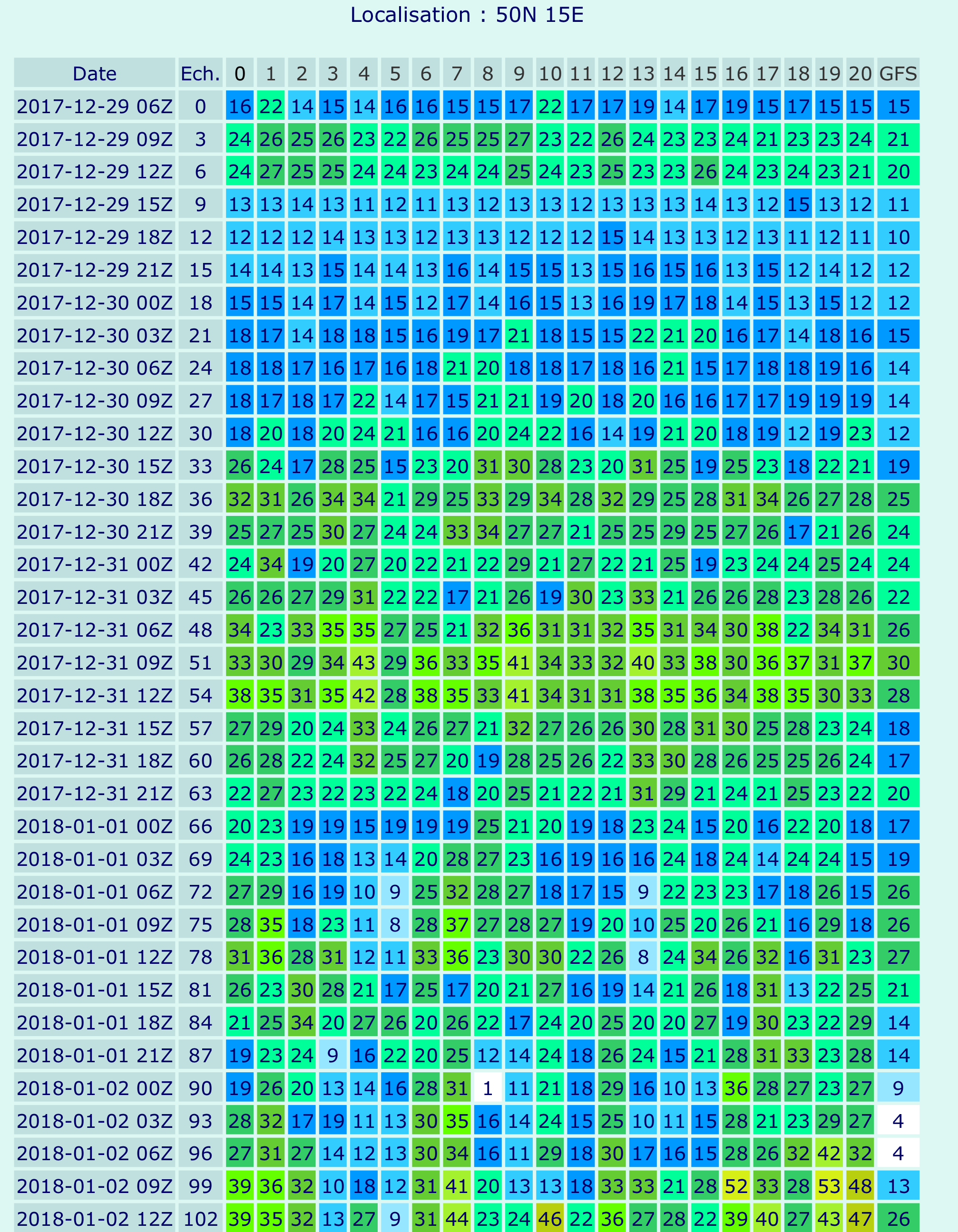 |
Streamlines 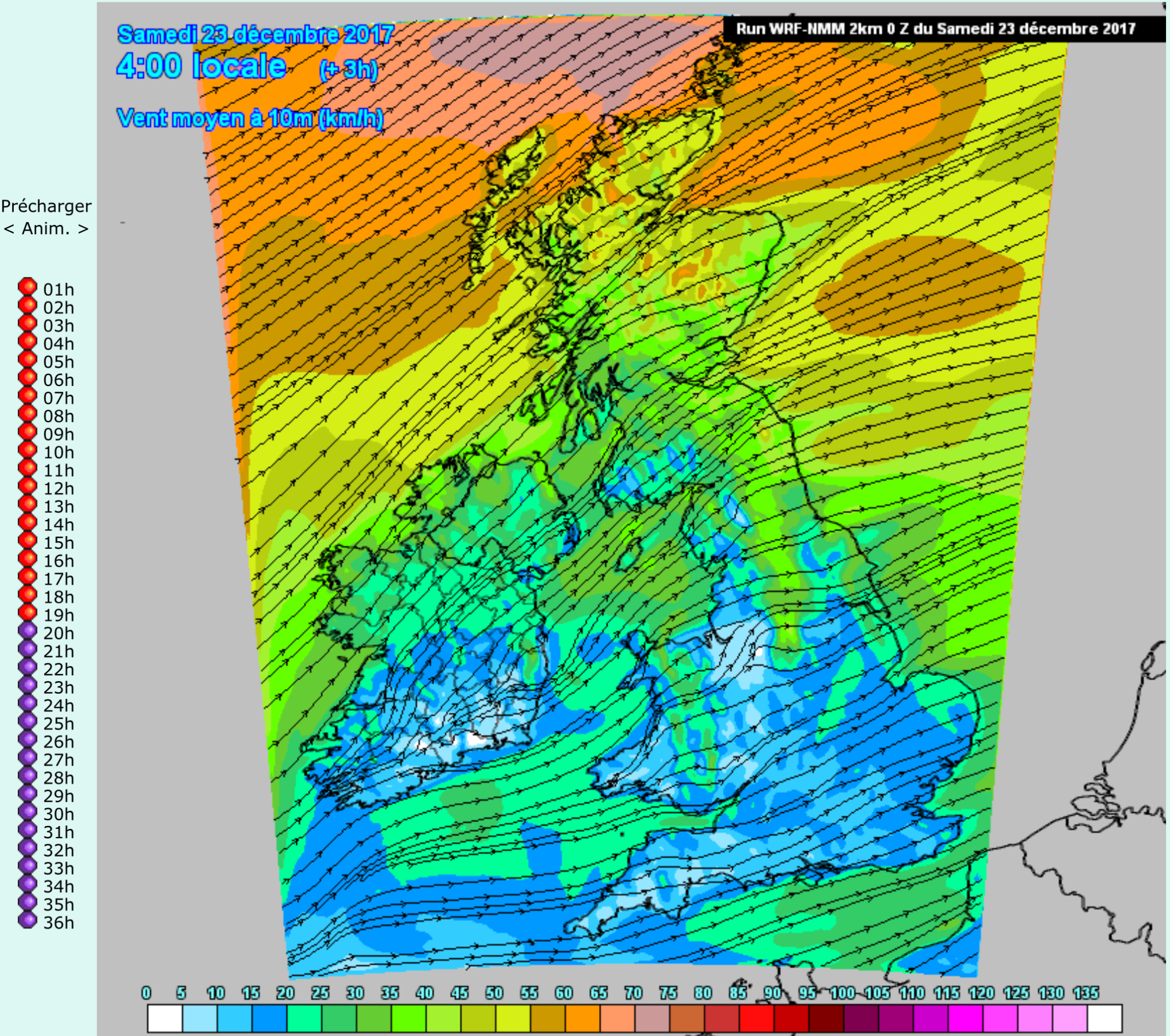 |
Many charts are in streamline format. Not everyone will like that. Ensemble results are shown and give an idea about reliability of a forecast.
Weatheronline
A jumbo site of weather information derived from GRIB output.
There are many weather Apps – use Google to see what is available. Most will simply be different presentations of GFS and WRF output with no human input. The only real differences are likely to be the gimmicks employed to make them attract users. Few will have anything substantive for sailors.
Return to
Return to