
XyGrib is a greatly improved derivative of zyGrib which is no longer supported. XyGrib is the only browser GRIB app known to me that lets you define precisely what information you wish to download.
Introduction
XyGrib is a GRIB visualisation package and a forecast service with Linux, MacOSX and Windows versions under General Public Licence. It is free to all on a non-commercial basis but the providers do need and ask for contributions.
Latest versions of the software can be downloaded from the OpenGribs site. Most convenient is the the Online Installer as this requires a smaller initial download. The application, static data and optional high resolution maps are downloaded are all available when you run the installer. All future updates are then downloaded with the XyGrib Maintenance Tool that the installer leaves on your system.
Setting up and using
This is all very intuitive. Areas can be selected by drag and drop or entry into a frame. Map projections can be chosen as well as amount of detail such as rivers, coastline definition, cities, latitude/longitude grid, scale.
XyGrib request panel
This is from XyGrib V1.2.4
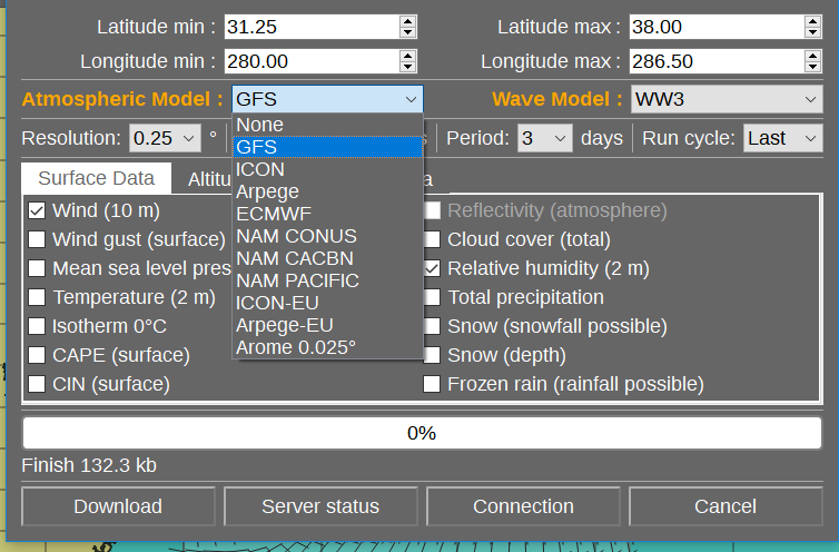
Weather elements required, number of days and time step are all entered into a frame as shown above. The selected area can also be amended here. By default, it will use your last selection.
Computer models available are �
Global models.
NOAA-GFS. 0.25, 0.5, 1.0�. 00, 06, 12, 18 UTC, 1-10 days.
DWD ICON, 0.25�. 00, 12 UTC , 1-8 days.
ECMWF � Surface pressures only, 0.5�. 1-3 days.
M�t�o Frsnce Arpege, 0.5�, 00, 12UTC, 1-4 days.
Wave models
NOAA WW3. 0.5�, 00, 06, 12, 18UTC, 1-4 days. Not Mediterranean
DWD GWAM. 0.25�, 00,12UTC, 1-6 days. Includes Mediterranean.
DWD EWAM. 0.05� x 0.1�, 00,12UTC, 1-4 days. Europe and Mediterranean.
Detailed models.
DWD ICON-EU. 0.06�,
NOAAA NAM, USA, Caribbean, Pacific (Hawaii). 0,11�
M�t�o Frsnce ARPEGE-EU, 0.1�
M�t�o Frsnce AROME, 0,02�
XyGrib forecast example
Example of ICON-EU 6km output. Step on times using the Left/Right arrows - top left of the chart or by using Page Up or Down.
Although finer grid spacings are available with AROME, for example, this spacing is sensible in practical terms. Small weather features have limited lifetimes.
Instability indices and rain areas
A useful facility with XyGrib is the option to download the CAPE (Convective Available Potential Energy). This frighteningly named parameter is an indicator of strong convection and, therefore, the risk of severe thunderstorms and lightning.
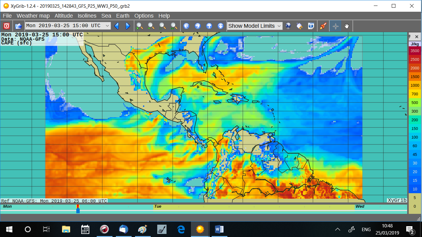
This example shows part of the Inter Tropical Convergence Zone with its usual great instability. This is a clear warning of vigorous convection and a high thunderstorm and lightning risk. An alternative parameter is CIN
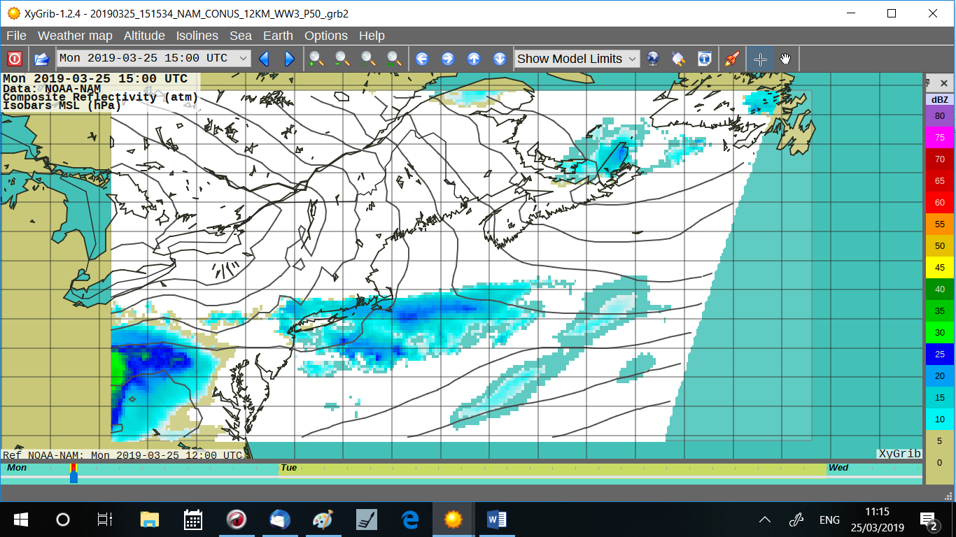
Some of the detailed models also provide forecasts od radar reflectivity. Essentially a prediction of what the radar will see. This is an example of weak frontal rainfall over the NW Atlantic/N America.
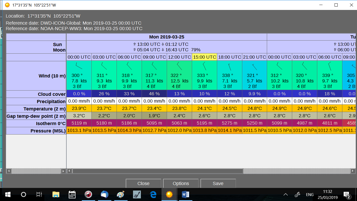
Weather sequences (meteograms)
This is a useful facility. Select a point on a XyGrib display by right-clicking. Select Meteotable from the small window that opens.
Return to main GRIB page
Return to home